Wednesday, May 14, 2025

Bisti Badlands, New Mexico


Ellen on a walk in the Bisti Badlands.
(Click images to view larger)


The term "badlands" sounds harsh, but barren eroding landscapes have been called that for centuries. Here in New Mexico, craggy lava flows, though not erosional, are called malpaises (bad country or bad places). French trappers called badlands les mauvaises terre a traverser, meaning “bad lands to traverse,” perhaps the origin of the English term. The trappers were probably influenced by the Lakota (according to Wikipedia), who called these places mako sica (bad or eroded land). Regardless of language, it’s not hard to understand why landscapes nearly devoid of vegetation and animal life might have been considered “bad” if you needed to find dinner or get across them on a hot day.

But it’s all relative. If I were a French trapper, or Lakota, or a Spanish conquistador, or even a modern farmer (or an antelope), I might find the term appropriate, but as a wanderer camping in empty places with my camera, badlands doesn’t ring true. I’ve had some pretty good times in some pretty bad lands. 

Badlands National Park, by virtue of being a park, is probably the most recognized badlands site in the U.S., but it’s one among many equally spectacular places. If you saw the movie, Nomadland, you’ll remember that Fern, played by Francis McDormand, spent time working at a campground near the South Dakota Park and found herself calmed by its beauty, though she eventually moved on, as nomads do. Ellen and I visited colorful badlands in Oregon in the John Day Fossil Beds National Monument on our first road trip after retiring in 2021 before moving on ourselves to float the John Day River in our packrafts.

Ellen in the Painted Hills at the John Day Fossil Beds, Oregon.

Wyoming’s Red Desert, where I spent lots of time before moving south, has national park quality badlands, though wilderness protection might be more appropriate for these remote places. The Honeycomb Buttes in the northern Red Desert and the Adobe Town and Skull Rims farther south are spectacular and little-visited, at least compared to the South Dakota badlands. I once camped on the Adobe Town rim with Ellen and Bei and discovered a family of coyotes with pups denned in an eroded hole just below our camp. They seemed undisturbed by us, maybe remote enough not to have been harassed by humans. On a hot day during another Adobe Town trip, I found a soapstone medicine pipe in the cool shade of a rock tower. 

A wash below the Skull rim in Wyoming.

New Mexico, where I live now, has more than its share of badlands. I’m just beginning to learn about them and have only recently begun to explore. Some of the most well-known, are the Bisti (pronounced Bist-eye, not Bist-eee) Badlands south of Farmington. The Bisti are part of the Bisti/De-Na-Zin Wilderness Area surrounded by Navajo, BLM, and private lands. In recent years they’ve gotten increasing attention, probably because their weird erosional formations attract photographers, but when we were there in April (2025), despite a surprising number of campers in the main parking area, we mostly had the place to ourselves as we wandered among hoodoos, “cracked eggs,” and petrified wood. 

A downside of the term “badlands” is that some think that they are literally bad, with little value except perhaps for oil and gas drilling or other destructive activities. This, of course, is not the case. Badlands are beautiful and unique, deserving of preservation.

Early morning in the Bisti Badlands.

Bisti Badlands.

Bisti Badlands erosion.

There are a few hardy shrubs in the badlands.

Formations known as the stone wings in the Bisti Badlands.

The nearby Angel Peak area is also vast and eroded.


Saturday, March 15, 2025

Public Lands Threatened

Sunset in the Potrillo Mountains, part of the Organ Mountains-Desert Peaks National Monument in New Mexico.
(Click images to view larger)

In late February, Ellen and I hiked into Aravaipa Canyon in the heart of Arizona’s Aravaipa Wilderness (BLM). A clear stream, unusual in the desert, flowed beneath cottonwood trees, leafed out to gather early-season Arizona sunshine. We disturbed a coati in one of them—it crept slowly to the ground and disappeared surprisingly quickly and a little comically into riparian vegetation. After a fun day of walking and exploring, we set up our tent under volcanic cliffs beside the stream and enjoyed miso soup, freeze-dried dinners, shortbread cookies, and a warm quiet evening under bright stars.

Volcanic cliffs above a side canyon in the Aravaipa Wilderness photographed during a February backpacking trip.

In mid-February, we car-camped with friends on the rim of the Kilbourne Hole, a volcanic maar crater in a remote part of the Organ Mountains-Desert Peaks National Monument. We’d spent the day finding petroglyphs and evidence of Pleistocene mammals near a volcanic cone. Our campsite commanded a view across the crater to the Riley Peaks, three high points in the Potrillo Mountains, one of several desert ranges in the Monument. The site had clearly been enjoyed by ORV users, and we spoke with two friendly guys from El Paso in a side-by-side when they stopped to enjoy the view. They were originally from Quebec, and it was surprising to hear French so close to the Mexican border.

Ellen with our friends Steve and Beth Buskirk on the rim of the Kilbourne Hole in the Organ Peaks-Desert Mountains National Monument. February 2025.

Earlier in February, we camped with our Laramie friend, Ed Sherline, in the Uva Mountains near the end of his bikepacking trip around the Desert Peaks. He'd covered sixty miles a day for five days circumnavigating much of the Monument and was feeling (and looking) a little grizzled when we met him on his last night. It was cold at night, but sunrise behind the Organs merited an early wake-up to enjoy layers of mountains and haze in the morning light. 

The Organ Mountains at sunrise taken from a camp in the Uva Mountains.

Those are just three of many experiences I had on public lands in February. My life and the lives of many of my friends have been enriched by these lands for well over a half century. Going back further, my father's family loved the West, and tales of their trips from Dearborn, Michigan to the Tetons in the 1940s drew me to them starting in the late-1970s, changing the course of my life. How many American family histories have been influenced by our federal lands? How many of our lives have been changed?

My father, Ed, and his mother, Nelle, on a trip west from Michigan in the 1940s to visit Grand Teton National Park, at that time less than twenty years old. The photo was probably taken by my grandfather, Ken.

In the U.S. today, few issues are nonpartisan, but protection of public lands unites people from across the political spectrum. The freedom to vacation in National Parks, explore National Monuments, hunt and fish in National Forests, birdwatch in Wildlife Refuges, or wander through remote BLM lands is fundamental to our way of life, yet we win public land battles, never the war. Who are the legislators braying loudly for the sale or transfer of federal (our) lands even while their constituents (we) object?

Ultimately, they are driven by special interests that benefit from reduced regulations so that they can more easily exploit our lands for their profit, meaning that it’s worth their while to contribute campaign funds and pay lobbyists. Oil and gas, mining, timber, and large corporate agricultural interests profit while the rest of us stand to lose our heritage, our primary means of recreation, and our avenue for enjoying the open spaces about which Westerners, including many of those trying to take them away, wax poetic with stories of free-roaming cowboys and Big Sky Country. 

In 2024, Utah filed a lawsuit at the U.S. Supreme Court that would have required the federal government to sell or “dispose of” more than 18 million acres of our public lands in Utah despite Utah’s agreement upon being granted statehood to “forever disclaim all right and title” to federal public lands. Twelve states supported this attempt even in the face of broad opposition by the public, but many did not. Martin Heinrich, a U.S. Senator from New Mexico, where I live now, stood against this, declaring, "We must stand united against this un-American land grab to ensure that our public lands remain accessible and protected for future generations. Our public lands are not for sale. Full stop." Thankfully, early this year, the Supreme Court declined to hear the case, a battle won while the war continues.

Ellen and our friend, Bay, admiring pictographs in the Bears' Ears National Monument established by Obama, shrunk by Trump, re-grown by Biden, and now vulnerable again. Of course, before Europeans, all lands in N. America were public. Cultural resources like these pictographs deserve to remain protected.

The Wyoming legislature was one of the supporters of Utah’s suit. I lived in Wyoming for nearly 45 years and spent countless weeks in its spectacular public lands along with many of my fellow Wyomingites of all political stripes. Recently, Wyoming legislators tried to pass a resolution transferring much of the federal land in Wyoming to the State. Fortunately, this resolution was defeated even in one of the reddest states in the U.S. underlining bipartisan support for protection of public land. Other efforts in Wyoming this year attempted to limit the right of private landowners to transfer land or land rights to the federal government. Many supporters of these measures in the Wyoming House are members of the Freedom Caucus. WTF?

Sunrise in the Honeycomb Buttes--BLM land in Wyoming's Red Desert. 2013.

Public lands continue to be threatened. NPS, BLM, USFS, and U.S. FWS employees are being fired, National Monument boundaries are in jeopardy, and special interests advocate for sale or transfer of our land. Many across our political spectrum are fighting these threats, but many others are complicit, and the war is never won. We can help by writing letters, attending rallies, donating funds, volunteering, and voting. Don’t let the few take away or degrade lands that belong to us all.

Gated and posted private ranchland adjacent to the Gila National Forest in New Mexico. Private landowners have the right to keep people off of their land, but we don't want our public lands to become private and locked away from us.

Thursday, January 9, 2025

Visiting Paquime in Chihuahua, Mexico

The ruin of Paquime near Nuevo Casas Grandes in Chihuahua, Mexico.
(Click images to view larger)

In December 2001, not long before we became parents, Ellen and I drove from Laramie, Wyoming to El Potrero Chico, just north of Monterrey, Mexico to rock climb, and then we continued across northern Mexico to the city of Chihuahua before reentering the U.S. south of Marfa, Texas. At that time, travel in the Mexican borderlands felt safe, and we enjoyed exploring small towns and the big city of Chihuahua. I still remember a misty and chilly sunrise in Parral (a town along the way) with views to the southwest into intriguing mountains that are now a no-go due to cartel activity. 

Today, the U.S. State Department advises Americans to “reconsider” travel to Chihuahua due to crime and kidnapping, including the danger of violent gang activity, but there are relatively safe corridors and destinations, so last March (2024) a group of us organized a trip with Luis Benavadiz, a guide from The Pink Store in Puerto Palomas, a Mexican border town south of Silver City, to Nuevo Casas Grandes, near the famous ruins of Paquime. We’d wanted to see Paquime for years because of its importance in Southwestern archaeology, and although we probably could have driven ourselves, Luis made the trip less stressful and showed us places along the way that we would have missed on our own. And we breezed past Federale checkpoints that might have been less friendly to a bunch of gringos. 

Paquime was an important political center that peaked after Chaco Canyon and other northern settlements were abandoned in the 12th century A.D. At the height of its importance, it may have been home to as many as 10,000 people, but by 1450 it was mostly abandoned. Paquime had a substantial number of enclosures for raising Scarlet macaws which were ritualistically important throughout Ancestral Puebloan societies far to the north. The Edge of the Cedars Museum in Blanding, Utah, for example, has a beautiful macaw feather sash in its collections that was found in the Abajo Mountains of SE Utah. Paquime may have had political influence over a large area, though there is debate about its extent. 
 
Luiz stuck to a choreographed 2-day plan on our trip, effortlessly herding us around. On the first day, we visited Mata Ortiz, south of Nuevo Casas Grandes to see (and hopefully buy) the pottery that they are famous for thanks to a nearby clay deposit. I was more interested in the town than the pots, so I slipped out of potters’ houses to photograph buildings, but enough of our group bought pottery to make the visit worthwhile for the potters and, I imagine, Luiz. We also visited the once opulent but now run-down Hacienda de San Diego, a sprawling ranch off the beaten track once owned by Luis Terrazas, the richest man in Chihuahua. In its heyday, it housed many workers, but most of the buildings are now in disrepair. 
 
The second day was mostly spent at the sprawling Paquime ruin, our main objective, but we also visited a neatly trimmed Mormon settlement with tidy houses and fenced lawns. Mormons escaping the ban on polygamy in the 1890s established colonies in Chihuahua, and Luiz said that many of the residents are now successful businesspeople who commute regularly between Salt Lake City and Nuevo Casas Grandes. By late on the second day, we returned to Puerto Palomas, walked across the border, and retrieved our cars from the dusty parking lot beside a Dollar General to return to Silver City.

There are many other temptations in Chihuahua, including the massive Copper Canyon, home of the Tarahumara people, known for their running prowess, and intriguing smaller but less visited ruins, not to mention the endless obscure mountain ranges hiding who-knows-what. Although unimportant compared to the impact of cartels on the lives of many Mexicans, it's heartbreaking to live so close to Mexico and not feel safe enough to explore there. But prudence suggests waiting and hoping that borderland tourism gets safer while we’re still spry enough to wander.

Peach trees (Mormon?) in an orchard along the highway. There are substantial Mormon settlements in Chihuahua originally established by fundamentalists escaping the U.S. ban on polygamy in the 1890s. Mitt Romney has family ties here.

An old store in Mata Ortiz, south of Nuevo Casas Grandes. This town is famous for its exquisite pottery, but I was more interested in walking the streets to look at buildings.

Another building in Mata Ortiz.

A screen door in Mata Ortiz.

Bottle caps above a doorway in Mata Ortiz. Why?

Another Mata Ortiz house.

Abandoned workers' quarters at the Hacienda de San Diego.

A vaquero's rope hangs outside an enclosed corral.

One of the workers' quarters.

An old tree beside workers' quarters at the Hacienda.

Graffiti in an Hacienda doorway.

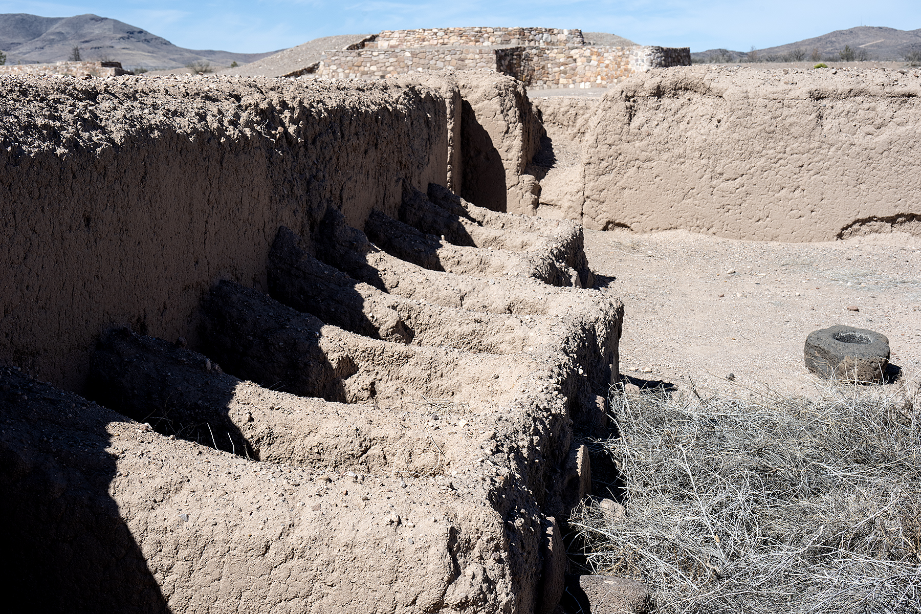
Paquime after excavation and restoration. The site covers a large area near the Casas Grandes river. Many Ancestral Puebloans may have migrated here after the collapse of the Chaco polity.

Luiz Benavadiz, our guide for the trip, at Paquime. He was funny, friendly, and knowledgeable. Luiz runs trips out of The Pink Store in Puerto Palomas.

Scarlet macaw breeding pens (but see comment below on macaws) at Paquime. Evidence suggests that these macaws did not lead happy lives. Macaw feathers are found over a vast area of Mesoamerica and the U.S. Southwest suggesting ritual importance.


Monday, December 9, 2024

Guadalupe Mountains, Texas and New Mexico

Our Lady of Guadalupe on a wall in Oaxaca, Mexico (2007).
(Click images to view larger)

In 1531, a Mexican peasant named Juan Diego and his uncle, Juan Bernardino, reported seeing several apparitions of the Virgin Mary, a.k.a. the Virgin of Guadalupe and Our Lady of Guadalupe, near Mexico City. Subsequently, depictions of the purported traveling virgin became iconic, and innumerable places throughout Mexico and the Southwestern U.S carry her name. On a recent outing, we visited the Guadalupe Mountains of SE New Mexico and West Texas, a National Park and home to Carlsbad Caverns and it’s Brazilian free-tailed bat population, which had already migrated south for the winter when we were there, leaving only its guano behind. Summer visitors can watch thousands of bats emerge from the cave at dusk and spiral into the night sky.

Mid- to late-November is autumn in West Texas, but fall color doesn't come to mind in the desert, so we were surprised to learn that trailheads would likely be packed with leaf-peepers. After the five-hour drive from Silver City, we walked to Smith Spring, a short hike into the foothills from a historic ranch. A ranger told us that autumn foliage at the spring was spectacular despite peaking a week or so earlier, but we were skeptical as we walked across the Chihuahuan desert towards a dry-looking canyon. But inside the canyon, clear pools of water seeping from a sandstone layer beneath limestone cliffs created a wet micro-environment supporting a lush grove of yellow Gambel’s oak, red and yellow bigtooth maple, bright green ferns and grasses, and a few pale yuccas and cacti to remind us that the desert wasn’t far away. It was surprisingly spectacular. 


We spent the rest of the week exploring the Guadalupes and Carlsbad Caverns. We hiked up Guadalupe Peak, the highest point in Texas (8,751’), and looked down on a limestone buttress called El Capitan. Larry Scritchfield and I bootlegged a mountain bike ride beneath El Capitan on a rest day during a Hueco Tanks climbing trip sometime in the 1980s or 90s (I can’t remember exactly when) before the Park was so popular (and so well patrolled) and before I had a bike with shocks. Ellen and I hiked into McKittrick Canyon, another autumn color destination where a petroleum geologist named Wallace Pratt built an inviting stone cottage in the 1930s that he later donated to the Park. We climbed the three easiest rock routes in Last Chance Canyon, a limestone gorge north of the Guadalupe Mountains know for harder climbs in steep alcoves. And we hiked 750’ down into the earth through Carlsbad’s natural entrance on the switch-backing asphalt tourist trail. It led us and a bunch of other people, some making videos of every feature with their phones (I pity their friends and families), through a labyrinth of passages and rooms and eventually to the underground restrooms and snack bar (closed) near the elevator that most visitors use to exit the cave. We chose to hike out the way we’d come in and were lucky to have the cavern to ourselves after the last tourist entries at 2:30 p.m. passed us on their way down.


We’re told that spring is also lovely in the Guadalupes, with wildflowers and white madrone blossoms set off by the mahogany-brown bark. We'll return, and if we’re lucky, Our Lady of Guadalupe might appear in our latte foam at the Blue House Cafe in Carlsbad if we stop there to for a pastry and a pick-me-up on our way home. 

Smith Spring in Guadalupe National Park. 

Yellow bigtooth maple at Smith Spring.

Fall colors at Smith Spring.

Limestone fins in viewed from the trail up Guadalupe Peak.

El Capitan from the Guadalupe Peak Trail with West Texas stretched out to the south. 

Ellen near the summit on the Guadalupe Peak Trail.

A lone bigtooth maple in McKittrick Canyon.

Looking down into the maw of Carlsbad Caverns from the natural entrance. The trail descends 750 vertical feet into the cavern but doesn't reach the lowest levels.

The Virgin of Guadalupe peers out from a window in Oaxaca, Mexico (2007).


Sunday, October 13, 2024

Edinburgh, Scotland


Edinburgh as seen looking east from the castle towards Arthur's Seat.
(Click images to view larger)

Arthur’s Seat is a volcanic mound rising above the east end of the Royal Mile, the busy heart of Edinburgh tourism. On our second full day in town, we walked upwards through thick fog to the top and imagined the view if one could see more than a few feet into the grayness. On the descent, a substantial Scottish man slogging upwards with his family announced to his wife in a thick (to us) accent, “I could be drinkin’ in the pub, but instead I’m up here with you in the mist.” 


I’m not a patient city tourist. It’s not that I don’t like what cities offer, but after a few urban walks, however interesting, or museum visits, however engaging, I find myself looking forward to quiet breaks from the crowds and my attention narrowing to the next restaurant choice. But cities have their charms, and we easily filled a couple of days in Edinburgh before heading out to the Isle of Skye and the Highlands


To be fair, Edinburgh is a great city—it’s chocked full of historical buildings, the restaurant scene is lively and diverse, people are friendly and polite despite all the tourists, transportation is easy, and there is no end of things to do, including festivals, museums, tours, hikes, and drinking. We jumped in with both feet—walking up and down the Royal Mile, visiting the castle, hiking up Arthur’s Seat, eating good Indian food—before driving out of Leith on the “wrong” side of the road in our Eurocar rental. There's much more to embrace in Edinburgh than its tourist hub for those with more city energy than I have, but we were excited head north. 


Once on Skye, we were happy to be walking “in the mist,” safe in the knowledge that even in the windswept wildness of the Hebrides, a warm pub was never far away.


A bagpipe busker on the Royal Mile. When you walk out of Waverly station, tired from 24 hours of travel, the pipers, out to earn a pound or two, make it clear that you aren't in Southern New Mexico anymore.

Stained glass in Tron Kirk, a former parish church that has been converted into a craft market.

On our arrival in Edinburgh, we sat in a small square behind Tron Kirk waiting for check-in time at our Airbnb so that we could go to sleep. I thought this guy looked sketchy, but soon young women and their mothers were chatting amiably with him about his dog, eroding my American distrust of strangers.

A street parallel to the Royal Mile.

An old sign from the days before tourism at the entrance to a "close" (side alley used to access residences) off of the Royal Mile.

A detail in the ornate ceiling of St. Giles Cathedral. St. Giles is the patron saint of lepers and was also popular in medieval Scotland. 

A cathedral in the mist.

A "wynd" (winding side street) off of the Royal Mile.

Headstones at the Cannongate Kirkyard date to 1600s. We stopped here to explore on our way to Arthur's Seat, and I was surprised to stumble upon the grave of Adam Smith, the famous economist.

In another close, a poster reproduced descriptive passages from a reference book published in the 1700s by James Tytler called "Ranger's Impartial List of the Ladies of Pleasure in Edinburgh".

Ellen in the mist on our way down from Arthur's Seat.

A ruin above Holyrood on Arthur's Seat.