Showing posts with label backpacking. Show all posts

Saturday, April 6, 2024

The Two-Track of My Fear: Backpacking the North and South Rainbow Bridge Trails


Rainbow Bridge viewed from the east, with snowy Navajo Mountain in the background. 
(Click images to view larger)

On the south flank of Navajo Mountain, deep in the Navajo Nation, we came to a fork in the dirt road leading towards the South Rainbow Bridge trailhead. A sign between the forks warned of private residences and said to “Keep Out” but didn’t specify which fork was private. 


We chose wrong, of course, and as we turned to go back the way we’d come, a Navajo man came out of his house to speak to us. I apologized nervously, but he was friendly, directing us to another road that bypassed his property. In the background, a woman stood in the doorway speaking loudly in Navajo, probably reminding us to read the damn road signs. The man ignored her, looking at my Transit camper (AWD, but still a van) and remarked, leaning over a little to check the clearance, that the road to the trailhead was “a little rough” but that I could “probably” make it. Scott and Bay were in a 4WD Tacoma, better suited to bad roads.


Once on the bouldery two-track leading to the trailhead, I realized two things: 1) the road was not a “little” rough, and 2) once you started up, there was no turning around. Several days later, we met a group from Moab hiking the opposite direction with a young Navajo woman. One of them asked a little incredulously, “Is that your van at the trailhead!!??," assuring me that, "We’ll keep you in our thoughts.”


The next morning, we loaded our packs into Scott and Bay’s Tacoma and drove to the North Trailhead on a less rocky but steeper road to begin the 35-mile hike around Navajo Mountain to Rainbow Bridge and back to the van. 


Navajo Mountain is igneous, protruding through Navajo Sandstone cut into deep canyons extending radially from its foothills. Some of the canyons drain directly west into Lake Powell while others take a more circuitous route to the Colorado River. The challenge is climbing in and out of canyons as you walk across the grain of the drainages, but the rewards are glimpses of beautiful riparian oases just greening up in the early spring warmth, dotted with blooming redbud trees, and of course Rainbow Bridge itself, a huge arch spanning Bridge Canyon. Most people who see Rainbow Bridge come from Lake Powell, leaving rented houseboats at a Park Service dock a mile or so west of the formation, but the first glimpse of the Bridge from the east is unique and untainted by the bathtub ring left by the shrinking reservoir.


On each of the four nights we spent on the hike, we turned in soon after dark, as campers of a certain age do when the chill of evening sets in. In my tent, I read David Roberts’ “On the Ridge Between Life and Death,” his memoir grappling with his climbing obsession and its consequences. Roberts retells the story from his first book, “The Mountain of my Fear,” an account of the first ascent of a fierce alpine route on Mt. Huntington in the Alaska Range, where one of his partners was killed in a rappelling accident after summiting. Later, after putting the book aside, I lay awake wondering if I’d be able to drive the van back to the highway at the end of the trip, and the consequences if I couldn’t. I doubt that my anxiety matched that of freezing alpinists fighting storm-battered and corniced Alaskan ridges, but it kept me awake for a at least a while each night when I should have been thinking about redbud blossoms or listening to the Western screech owl outside my tent.


We awoke on the final morning to the sound of light rain on our tents, but a nearby sandstone alcove provided a dry place to make breakfast, and the rain stopped just in time to start the long climb to the south trailhead where the van waited. As we climbed, the rain turned to snow but never accumulated. And in the end, the drive out was mostly downhill, easier than the drive in with gravity helping to push the van over the rocks. We camped that night on the north flank of Navajo Mountain just as the storm cleared, with expansive views over intriguing canyon country deep in Navajo country. Bay rode my bike the last three miles to retrieve her Tacoma, saving me the risk of getting stuck on the steep, muddy road, while Scott and I enjoyed a cold drink and got dinner organized. 


Anxiety is seldom caused by time away from modern conveniences (like camper vans) but instead by the specter of returning to them. 


Scott Lehman and Bay Roberts packing gear at the south trailhead, where we camped before shuttling. 

Hiking into a vast Navajo Sandstone landscape on the first day after leaving the north trailhead.

A modern Navajo petroglyph, reminiscent of older Navajo petroglyphs at Sand Island along the San Juan River NE of this hike.

Descending into a canyon on the first day.

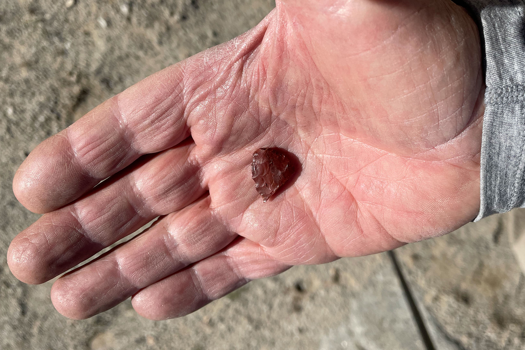
Surprisingly, we saw very little archaeology on this hike, but I found this arrowhead (and left it where found) in some dunes near the trail.

In mid-March, it was early spring in the foothills of Navajo Mountain, with cottonwoods and Gambel oaks greening up and redbud trees starting to bloom. 

Our first view of Rainbow Bridge. At first it seemed like a geomorphic impossibility, but as we walked closer it revealed some of its secrets.

Rainbow Bridge from the northwest.

The Echo Camp near Rainbow Bridge was home to at least a dozen folding metal cots. If only they had left folding metal chairs. The camp was home to a pair of Western screech owls and lots of bats. We spent two nights at the Echo Camp and day-hiked to the Rainbow Bridge and Lake Powell.

One of the cots, none of which appeared compatible with the inflatable thermarest mattresses we carried.

Bay and Scott hiking through narrows on our fourth day.

My tent on the last morning of the hike. Rain turned to snow as we climbed to the south trailhead, but it was beautiful to see water flowing in the canyons.

Waterfalls and potholes.

Scott and Bay starting the long climb to the south trailhead.

The view from near the top of the climb on the last day. Our last camp was in the narrow part of the valley far below.

Logistics and Links

  • The North and South Rainbow Bridge Trails can each be hiked as out-and-backs or connected as a point-to-point hike (~35 miles) like we did if you shuttle cars. 
  • A permit from the Navajo Nation (easily obtained) is required, and hikers are asked to stay on route (the permit isn't a license to explore other parts of the Navajo Lands). 
  • The south trailhead is approached from a dirt road off of Navajo route 161, which itself is a fork of Rt. 16. Detailed directions and information about the South Trail are found here. Once on the dirt road, stay LEFT at the sign announcing private residences and then turn right once past the sandstone dome. 4WD and high clearance are strongly recommended for the final 2 miles to the trailhead.
  • The north trailhead is also approached from farther north on Rt. 16. The dirt road off of 16 is good to the top of a steep drop (camping on the left before the drop) but then deteriorates quickly. 4WD and clearance is again recommended for the final 3 miles to the trailhead. Detailed directions to the north trailhead and information about the North Trail are found here.
  • The hike is about 35 miles. Traveling from north to south, there was water and camping at Surprise Valley, the Echo Camp (near Rainbow Bridge), and the First Water camp when we hiked in March, 2024. These water sources are well-spaced for camping on a 4-day/3-night hike. Check for current water availability if possible. General information about the hike is found here.
  • There are many online accounts of people's hikes to Rainbow Bridge (e.g., Arizona Highways). 


Tuesday, January 2, 2024

Exploring Fable Valley


Fable Valley in fall color. Archaeological sites occupy both sides of the canyon, the sagebrush flats, and even the tops of sandstone towers like the one in the distant background.
(Click images to view larger)

Fable Valley cuts into the Dark Canyon Plateau joining Gypsum Canyon before emptying into the Colorado River deep in Cataract Canyon. In 1869, during his descent of the Green and Colorado, the one-armed John Wesley Powell hiked into Gypsum from the river, nearly getting caught in a flash flood and turning back before reaching the mouth of Fable Valley. 


Our trip last October was less dramatic than Powell’s, but it required driving 40 miles on occasionally narrow and exposed dirt roads to reach the trailhead. I was grateful for both arms as I gripped the steering wheel of our van, hoping not to encounter oncoming traffic (we didn’t). We spent four days in the valley and two full days searching for archaeology, wandering up- and down-canyon from camp, scrambling up boulder-studded slopes to ruins or rock art sites and never traveling more than a couple of miles as the crow flies because there was so much to see.
 

Had Powell made it into Fable over 150 years ago, he would have found mostly undisturbed remnants of a substantial Ancestral Puebloan community spread from one end of the canyon to the other, with Mesa Verde style cliff dwellings and granaries in high alcoves and multi-room settlements in the sagebrush below. In the interval between 1869 and 2023, most of the ruins were scavenged, though pot sherds and lithics remain. Gordon Baldwin superficially surveyed the valley in 1949, describing 24 sites but noting even then that “…from the number of ruins that show signs of digging, it is evident that pot hunters, including a number of unauthorized expeditions, have been active in certain sections for some time.”


Even during Baldwin’s trip, a few remnants of settlements stood where today there is only sagebrush. We searched actively for a “ground ruin” below the largest cliff dwelling a mile or so upcanyon from our camp and found only pot sherds and a few low walls. Baldwin observed that the same site “seemingly contained more than 200 rooms and probably stood more than two stories in height,” while also describing a seven-foot-high corner wall that “may represent all that remains of the rectangular towers noted by [Dr. Byron] Cummings.” Cummings visited the valley in 1909, only 40 years before Baldwin when the ruins were less disturbed. When we visited, even the corner wall was gone. Despite that, finding what remains was exciting and fun.


Baldwin published his findings in the Southwestern Journal of Anthropology but admitted that “Due to the hurried nature of the trip and other phases of the recreational aspects of the region that had also to be investigated [emphasis mine] comparatively little time could actually be devoted to archaeological exploration.” Despite those weasel words, his paper contributed to our then sparse knowledge of the region. 


Like Baldwin, we were a little hurried, spending only four days car-to-car since some of our group of six had to return to work and others had plans to “investigate other phases of the recreational aspects of the region,” as Baldwin so eloquently put it. 


A structure in an alcove down-canyon from our camp, accessed by scrambling from above and traversing across a ledge.

The group at the structure in the previous picture. Left to right: Ellen, Bay, Jane, Steve, and Larry.

A handprint panel with stylized hands painted with concentric lines.

We saw many pot sherds but no snakes, probably because the fall nights were getting cold.

Bay (left) and Ellen scouting for sites.

A circular wall on top of the tower visible in the photo at the top of this post. Accessing it required an easy 4th-class scramble up a ledgy weakness. 

Bay and Jane descending from the tower.

Pictographs near our camp. All of the figures are connected.

Fable Valley itself is appealing even without the lure of archaeology. In October, cottonwood trees were approaching peak color.

On our second full day we explored up-valley from our camp, hiking towards the sun through backlit  grasses and shrubs.

Indian rice grass and other grasses and shrubs in the morning sun.

Pictographs and handprints.

A granary looks out over Fable Valley from an alcove in a side canyon.

Larry entering the most prominent ruin we visited, high above the valley floor. This ruin has been preserved to some extent. Replaced roof logs were cut with saws rather than fire, and portions of walls were rebuilt. 

Ellen, Larry, and Bay approaching a ruin. Steve had hiked out earlier that day to return to work. 

Jane and Larry clawing their way out of a gully in the valley on the hike out. The deeply incised creek and its side drainages were hard to cross. I suspect that when the valley was occupied, they were shallower.

Back at the trailhead and ready to "investigate other phases of recreational aspects of the region." 
L to R: Bay, Larry, Jane, Ellen.


References

Adkison, Ron. 1998. Hiking Grand Staircase-Escalante & the Glen Canyon Region. A Falcon Guide.

Baldwin, Gordon C. 1949. Archaeological survey in Southeastern Utah. Southwestern Journal of Anthropology 5(4):393-404.

Cummings, Byron. 1910. The ancient inhabitants of the San Juan Valley. Bulletin, University of Utah 3(3) Part 2.

Midwest Archaeological Center National Park Service, Lincoln, Nebraska. 1978. Archaeological resources of Canyonlands, Capitol Reef, and Arches National Parks and Natural Bridges National Monument, Southeastern Utah. Vol. 1. 

Road Trip Ryan (website)


Saturday, January 28, 2023

Death Valley Backpacking: Cottonwood - Marble Canyon Loop

View of Death Valley badlands from Zabriskie Point.
(Click images to view larger)

Death Valley is famously hot, dry, and barren, but cold temperatures, flooding, and bushwacking posed challenges during a short visit in January 2023. The park is nothing if not diverse, with elevations ranging from 292 feet below sea level in Badwater Basin to over 11,000’ at the summit of Telescope Peak, so it's not surprising that conditions don't always match the cliches. When I met Larry Scritchfield for a little mid-winter backpacking (and to escape the relentless Wyoming cold), high temperatures averaged around 60 in the basins, way warmer than the surrounding mountains where we hiked, many blanketed with snow. 


Salt Creek on the floor of Death Valley. The white stuff is salt, not snow. (Photo from Dec. 2021 when Ellen and I passed through on our way home from a climbing trip to the Alabama Hills west of Death Valley)

A pan in the Mesquite Dunes east of Stovepipe Wells. (Dec. 2021)

Gower Gulch from Zabriskie Point. Zabriskie Point is a popular roadside overlook, named for a borax magnate. (Dec. 2021)


We’d also hoped to get a taste of Death Valley canyoneering, known for rappels off carefully constructed rock piles (sketchy??), but our canyon partner, Don Reyes, who lives near Lake Tahoe, was digging his renters out of serial Sierra snowstorms and had to bail at the last minute. Canyoneering is collaborative--more fun and safer with three than two, so we postponed those plans.


Larry not canyoneering (still sketchy) in Stretched Pebble Canyon during a day hike. (Jan. 2023)


Larry and I rendezvoused at Stovepipe Wells, just below sea level, where a friendly hotel (showers for $5!) and restaurant on one side of Hwy. 190 face a campground and store on the other. The campground, mostly empty in January, is a gravel parking lot with carbonite posts marking sites, devoid even of picnic tables. We parked on one edge of the lot, giving us access to the empty desert for late-night peeing. Not far to the east, the Mesquite Dunes spawned plumes of dust that thankfully blew away from the campground on frequent windy days. To the west, the Cottonwood Mountains, part of the Panamint Range, where we planned to hike, dominated the skyline, their highest peaks dusted with snow. 


The Stovepipe Wells "campground." It's really just gravel parking places though there are some tent sites that have tables. The Cottonwood Mountains, where we eventually hiked, are in the background. (Jan. 2023)


Flash floods during the August (2022) monsoon washed out many roads in the park, including access to popular tourist spots (Scotty’s Castle, the Racetrack, etc.), and a smaller rain event just before we arrived turned the road to the 28-mile Cottonwood-Marble Canyon loop, our main backpacking objective, into a quagmire. An apologetic ranger at the small Stovepipe Wells station where we stopped to collect our free permit delivered the bad news, squashing our plan to start the 4-day hike that morning. Instead, we regrouped and headed for Indian Pass in the Funeral Mountains on the eastern edge of the park, an overnight out-and-back that included a 4-mile slog up an alluvial fan (fanyoneering?), while we waited for the Cottonwood Canyon road to dry out. 


Camp in the Indian Pass canyon in the Funeral Mts. (Jan. 2023)

Recent rains left plenty of water in potholes in upper Indian Pass Canyon. (Jan. 2023)


Later in the week, after the overnight and two day-hikes, we finally started the loop, which climbs gently up Cottonwood Canyon, then north up a swale to eventually cross a saddle before descending steeply into Deadhorse Canyon which drains into Marble Canyon, itself descending through spectacular narrows back to the trailhead. Along the way we enjoyed impossibly complex geology, petroglyphs (spaceships??), wild horses, freeze-dried lasagna, and perfect but freezing campsites. 


I seldom move much before finishing my morning coffee, and pre-caffeine I don’t even like to be asked about what I might do later in a day. But in one of the hottest places on the planet, it was so cold (and windy) at our first two camps that Larry and I crammed our gear into our packs at dawn and walked until we could find sunshine and a little warmth before brewing freeze-dried Via “coffee” packets and eating breakfast. Probably in the low to mid-20s at night, desert cold always feels colder than mountain cold. I hiked those mornings in the winter clothes (hat, gloves, long underwear, puffy) that I wear Nordic skiing at 9000’ in sub-arctic Laramie, Wyoming and still didn't feel quite warm.


Lower Cottonwood Canyon on our the first day of our loop hike. I ended up shooting iPhone photos on this trip because the sensor on my backpacking camera was unexpectedly dirty. (This and all Cottonwood-Marble photos are from Jan. 2023)

Our first camp in Cottonwood Canyon.

Larry enjoying a wee nip of tequila at our first camp in Cottonwood Canyon.

Larry in upper Marble Canyon.

Approaching one of the narrows in Marble Canyon.

Zebra-striped rock in Marble Canyon.

Petroglyphs in Marble Canyon.

Narrows in Marble Canyon.

Marble Canyon looking towards the narrows in the preceding photo.

Marble Canyon.

Boulder, Marble Canyon.

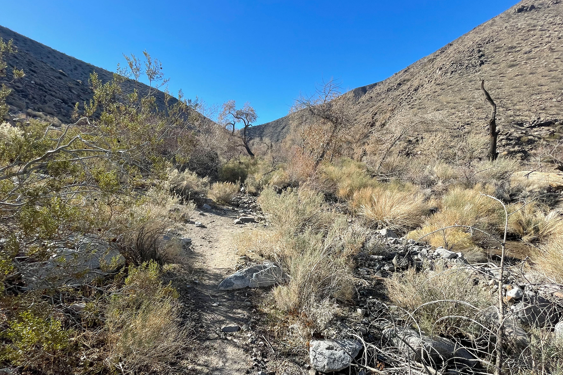
Another ironic challenge on the hike was vegetation. We joked about bushwacking on the Indian Pass hike whenever we passed close to an infrequent creosote bush. How naïve we were! In Cottonwood Canyon and to a lesser degree in Dead Horse Canyon, what little vegetation there was packed itself into the V-shaped drainages where the few springs provided enough water for trees, choking the canyon with an impassable tangle of downed cottonwood limbs, fallen trunks, and impenetrable shrubs, some thorny, forcing us up onto steep, loose, sidehills above the drainage, sometimes exposed enough to drive us reluctantly back down to bushwack hopelessly until we could find another escape. Short distances near these “oases” took longer to traverse than miles of open desert.

Approaching a section of bushwacking that is WAY worse than it looks. 

The only flake I found on this trip was this broken point that I happened upon while side-hilling above a spring to avoid bushwacking, so perhaps we were not the first to grovel around the springs.


Death Valley is a vast park, too hot most of the year for much activity, but a refuge in winter. From salt flats, dunes, and badlands to mountains harboring ancient but threatened bristlecone pines there’s enormous diversity. And despite the harshness, humans have left their mark with old mines, ghost towns, and remnants of a once thriving borax industry (20-mule trains!). It attracts desert rats and misfits as well as cyclists, outdoor adventurers, and retirees. I find myself there once in a while, and though I often wonder if I’ll return, each trip leaves me curious about just one more thing that I’d like to check out. 


View from an abandoned building at Death Valley Junction, just outside the Park.