Showing posts with label hiking. Show all posts

Friday, October 4, 2024

Hiking the West Highland Way, Scotland

The West Highland Way.
(Click photos to view larger)

Near the end of our sixth day on the West Highland Way, we passed an ancient graveyard and the ruins of St. Fillan’s Priory, now reduced to low moss-covered stone walls in a grove of trees by the trail. We didn’t linger, foot-sore and eager to get to Kingshouse, a couple of miles farther on, where we could probably buy a latte and something to eat, but we learned from interpretive signs that St. Fillan was an 8th Century Irish missionary who had settled in this part of Scotland. He was believed to have had healing powers and as an extra bonus, a left arm that glowed in the dark, which came in handy during Scottish winters as he huddled by a guttering fire copying religious works. I can imagine other uses for a glowing arm but also downsides: for one, it might attract midges, the obnoxious biting flies that famously swarm the Highlands during the summer months, driving hikers crazy. 

Mental illness in the 8th Century was mysterious and difficult to treat, but near the priory, a Holy Pool in the River Fillan offered hope to the afflicted or at least to their long-suffering caregivers. According to interpretive signs, the ill were led to the pool where they were released to wade in and recover stones, which were then placed carefully around a stone circle. Then they marched naked back to the priory to be tied “hand-and-foot” for the night to the altar beneath St. Fillan’s Bell with nary a glowing arm to light the darkness. If in the morning they had managed to escape, they were considered cured. It’s unclear what became of them if they didn't, but I doubt that it included lattes at Kingshouse, where we headed in haste, trying not to dwell on the 8th Century mental health safety net.  


We spent eight days in September hiking the West Highland Way from Milngavie, a northern suburb of Glasgow, to Ft. William, a largish town nestled between Loch Linnhe, an arm of the sea, and Ben Nevis, the tallest mountain in the U.K. The walk begins in the Scottish Lowlands and passes through rolling farmland and patches of forest before crossing a fault defining the edge of the Highlands. From there, a long rocky traverse along the shore of Loch Lomond leads to classic Highlands terrain—vast open moorland and u-shaped valleys beneath steep vegetated peaks called Munros if they rise to over 3,000’, Corbetts if they’re between 2,500’ and 3,000’, and Grahams if they're between 2,000’ and 2,499’. The trail in this northern section mostly follows an old military road, paved in stones in places and reduced to single-track trail in others. It descends at the end into Ft. William where one can board a train back to Glasgow or Edinburgh.


At well-spaced intervals along the way are small towns where walkers can stay in comfortable lodging if they plan ahead or campsites if they tough it out with full backpacks. Somewhat untypically for us, we chose the former, reveling in hot showers, comfortable beds, and hearty pub-meals and complaining only a little about the walking, barely laden with tiny daypacks stuffed with unused rain gear (we enjoyed unheard-of perfect weather) and snacks. Each night, our luggage was waiting for us thanks to a luggage transfer company that stays busy through the hiking season shuttling suitcases from place to place for hikers from all over the world. 


Trail cohorts leave Milngavie at the same time each day, often following similar itineraries, so hiking the WHW is social. We bonded with a couple from New Zealand and another from Canterbury (southern England) and joined them in the evenings for dinner and on the trail to chat when we could keep up, helping the miles go faster. We met hikers from the U.S., Canada, Israel, Thailand, France, Romania, and Germany, most when they passed us as we plodded along, wondering how people walk so fast. And of course, some people run the WHW and a few ride it on bicycles. Others have enough energy to bag Munros along the way, a sport of its own. If you bag all 232 Munros, you are dubbed a Munroist in Scotland, an honor that I will never attain. 

There are myriad websites and blogs providing fine-grained detail about the WHW, so I won’t go down that road, but I’ll add a few logistical notes after the photos below. We enjoyed the hike quite a lot, especially the northern half in the Highlands proper where more of the walking is away from busy roads and the scenery is gently spectacular. Knowing what I know after walking the WHW, I might choose to piece together something a little wilder if I were to return, but it’s a beautiful introduction to Scotland, and even with the crowds and the proximity to roads, walking it sure beats being tied naked to an altar beneath a bell without a glowing arm.


Ellen walking out of Milngavie, a suburb of Glasgow. The first few miles are in urban parks before the trail leaves that behind and enters rural farmland.

Typical terrain during the first day or two of the walk through rolling countryside divided by old stone walls. Once forested, most of this land has been cleared for farming and grazing. The tree in this image is a European mountain ash, thick with red-orange berries.

European mountain ash berries.

For Ellen, a near-vegetarian, all haggis is aggressive.

Speaking of haggis, here's an example of Mexican-Scottish fusion cuisine (Sco-Mex? Mex-i-Sco? Haggidillas?).

Ellen at the Clachan Pub in Drymen. Supposedly, this is the oldest licensed pub (1734) in Scotland, though I imagine there are many unlicensed pubs that go back further. The shelf all along the ceiling is lined with bottles of scotch from different distilleries. 
 
Scottish countryside near Drymen on the 2nd day of the walk.

Ellen descending Conic Hill toward Loch Lomond. Workers were busy using large boulders to build the trail, which made it tedious to navigate. I asked one of them how they managed to get the boulders up there, and he said, "this is where I have to make up a story about helicopters--nobody believes in magic anymore."

Forest near Balmaha was reminiscent of the Pacific Northwest.

Loch Lomond is a huge lake that we hiked along for two days before breaking out into more classic Highlands terrain.

"Honesty Boxes," few as fancy as this refrigerated one, are scattered along the trail for hikers. You're on your honor to leave money for any snacks and drinks you can't resist.

The view north into the Highlands from Loch Lomond.

The classic bar at the Drover's Inn at the end of our 2nd day. It opened in 1705 and supposedly, the famous Rob Roy (Scotland's Robin Hood) stopped in, though those stories seem a little like "George Washington slept here."

A stream along the trail. The landscape is gentle but streams cut into bedrock and are full of waterfalls, slots, and rapids.

Another stream incised into rolling hills.

A fencepost along the trail.

Beinn Dorain, a Munro, on day 5.

The Bridge of Orchy over the River Orchy at the end of the 5th day of our walk. The bridge was built in 1746 but has no trouble supporting a modern road. We sat beneath it soaking our tired feet until we could check into our comfy hotel beside the river.

The River Orchy in morning fog as we started out on day 6.

The slabs of Stob Dearg, another Munro, rising out of the fog on our 6th day. Climber note: There are technical slab climbs on this and other nearby peaks with "adequate protection" which, given Scottish climbing tradition, should make your palms sweat.

Ellen on day 7 with the trail stretching out before her.

The view down the Loch Leven valley with "The Pap" in the distance, called that "for obvious reasons" according to a local taxi driver we talked with.

Ellen approaching a stone ruin on the last day (8th) of the walk.

The infamous Ben Nevis near the end of the hike. At over 4,000', this is the tallest peak in the U.K. The side you can't see in this photo is craggy and has been the scene of Scottish mountaineering epics for centuries.

Ellen at the end of the walk in Ft. William. The WHW is supposed to be about 96 miles long, but Ellen traced it at over 110 on her GPS, and our feet were ready for a few days off.

Logistics

There is a wealth of detailed information online about hiking the WHW since it is probably the most popular long-distance trail in Scotland. I'll add just a few notes here.

Walking Companies: There are many companies that you can hire to make accommodation and luggage transport arrangements, and for us, this was a worthwhile and not very expensive way to set up the trip. We used Contours, and they did an excellent job--all of our accommodations were upscale, and transfers all went smoothly. Book as early as possible! We booked late (early June for a mid-September hike), so on several nights we had to take taxis (arranged by Contours) from where we finished walking to available accommodation. It would be much nicer to sleep where you finish walking each day. Do your research before choosing a walking company--Contours was great, and there are other good companies, but we heard from other travelers and taxi drivers that some companies are "rubbish."

The Walk: The walk is generally easy, without too much climbing and descending at least compared to what we're used to in the U.S. West where we do most of our backpacking. We did the walk in 8 days, which is fairly common (people do it in much shorter or a little longer times). This was reasonable, but we had some 17-mile days in the first half of the walk which felt long. Most of the latter half required only 9-12 mile days which is more relaxed. You could create an itinerary that breaks up those long early days. If you want a wilder walk with less people, there are many options, but they may require a little more planning to arrange.

Food: Our accommodations provided breakfasts, and they were hearty. We carried snacks for lunches, but you can buy packed lunches if you want something more substantial, and many of the towns along the way have places to buy food. We ate dinners out at universally good restaurants and pubs. Food is expensive in Scotland by our standards, but we went for it. There were always at least some vegetarian options at restaurants, including vegetarian haggis (made from vegetable livers and hearts wrapped in a vegetable stomach?).

Transport: Transportation to the beginning of the walk in Milngavie and from the end in Fort William is easily accomplished and inexpensive by train. See the Scotrail website.




Tuesday, February 6, 2024

The Cooke's Range, New Mexico

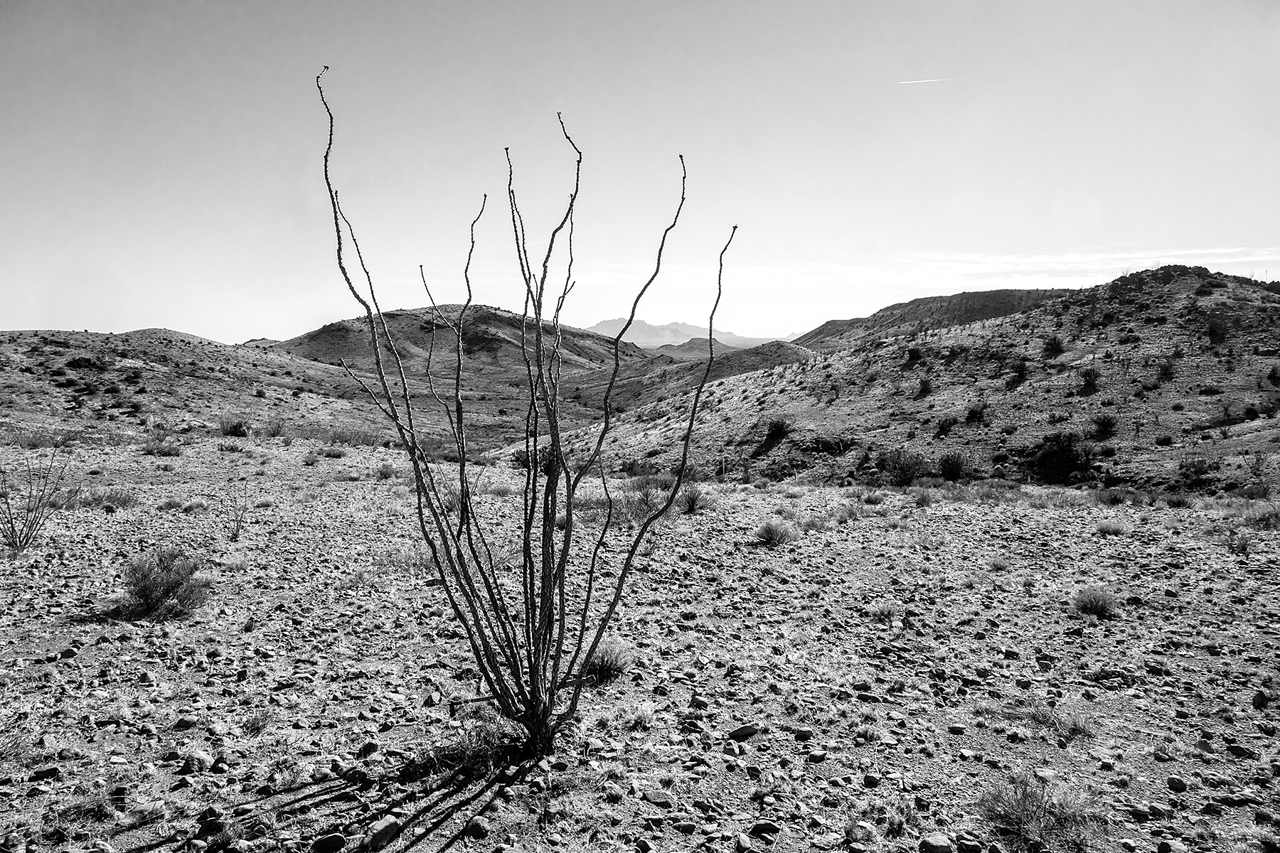
Ocotillo on Massacre Peak in the southern part of the Cooke's Range. 
(Click images to view larger)

Cooke’s Peak rises 2,400 feet above the remote trailhead where seven of us (and three dogs) gathered on a chilly January day for a long-anticipated hike to the top. The route climbs an alluvial fan and turns into OK Canyon where it winds through oak, sotol, and juniper before launching steeply upwards over two saddles to a short third-class summit scramble. We hoisted our daypacks and set off up the trail while the dogs ran around finding old bones and muddy puddles, covering at least twice the distance we did during an already long day.

Cooke's Peak (the pointy one) viewed from Mimbres Valley northwest of the range.

On the trail to Cooke's Peak with the Chihuahuan Desert far below.

The view east from near the summit of Cooke's Peak.


The peak dominates the northern end of the Cooke’s Range, one of many obscure “sky islands” rising from the desert basins of Southern New Mexico. Thanks to a perennial spring, it played a disproportionate role in U.S. and Mexican history and the U.S. doctrine of manifest destiny. Military, mail, and passenger routes between the East and California stopped at Cooke’s spring rather than bypassing the mountains because it offered the only reliable water between the Rio Grande and the Mimbres River. 


A lone ocotillo on Massacre Peak in the southern Cooke's Range with the Florida Mountains in the distant background. The easiest  east-west route is between the Floridas and the Cooke's Range, but there isn't any water.


Lt. Col. Philip St. George Cooke traveled the route in 1846-47 with a ragtag battalion of Mormon “soldiers” recruited in Iowa to bolster the U.S. military presence in the southwest, much of which was still owned by Mexico, and to diffuse tensions with the Mormons. They welcomed this because it gave them a chance to travel west funded by the military, escaping persecution in Iowa. After prolonged conflict and negotiation with Mexico, the Gadsen Treaty established the international border about where it is today, and the U.S. gained possession of Cooke's route.


Ellen near the summit of Massacre Peak just south of Cooke's Gap and west of the spring. A plaque commemorated the Cooke expedition as well as a group of boy scouts who visited the summit more recently, presumably to install the plaque.


Long before Europeans started arguing over ownership, the Mimbres chipped petroglyphs in the hills and canyons of the range. They are often fantastical, though some depict easily recognized rattlesnakes, sheep, bear prints, and yuccas. There are even the outlines of scarlet macaws on boulders in at least two sites. These tropical birds were traded (and maybe bred?) as far north as Chaco Canyon and its outliers and clearly had religious and cultural significance. Their feathers have been found attached to prayer sticks and ceremonial clothing. The Mimbres abandoned the area around 1150 AD, perhaps migrating south into Mexico. Bands of Apaches later established ephemeral camps in and around the Cooke's Range where they hunted and organized raids.


Petroglyphs in the Cooke's Range.

More petroglyphs including a possible macaw and Santa Claus roasting a dead rat over a fire??!!

Grinding holes in sandstone.
 

The Apaches were antagonized by the stream of Europeans threatening their sovereignty. Cooke’s Pass, just west of the spring and sandwiched between steep cliffs and hills for over a mile, was a perfect place to attack travelers, and the Apaches took full advantage. During one well-known attack in July of 1861, Mangas Coloradas and Cochise, two famous Apache leaders, ambushed seven members of the Freeman Thomas Mail Party as they entered the canyon, forcing them up a side canyon to the south where they built rudimentary rock shelters and fought the warriors until their inevitable deaths. According to an account by Jay Sharp, the stripped and mutilated bodies of Thomas and his companions were found two days later by passing freighters who described the scene:


The ferocity of the battle, the freighters said, could be measured by the numerous shell casings littering the ground and the bullet marks covering the rocks and trees around the stone barricades.”  


Ellen hiking through Cooke's Pass in November and feeling somewhat less terrified than travelers 150 years earlier, despite the 8-mile shadeless round-trip. 

We spent a day trying to find the site of this attack, but aside from a few ambiguous rock shelters, any signs of the battle have been erased by 160 years of weather and scavenging. This and many other attacks led to the construction of Fort Cummings near the spring in 1863 and deployment of military personnel to protect the vital transportation route. Today, all that remains of the fort are a few decaying adobe walls and a barren cemetery. 


Decaying adobe walls at Ft. Cummings, once a busy military outpost positioned to protect travelers from Apache attacks.
 
Lonely graves at the Ft. Cummings cemetery. The military was tasked with collecting human remains that had been left scattered along the route through Cooke's Pass and relocating them to this cemetery. The bones and bodies contributed to the terror travelers felt as they passed through the canyon.

After the Indian Wars, the Cooke’s Range was occupied by miners, goat herders, and ranchers. Abandoned towns dot the foothills today, and old mines are everywhere. To the west, Flourite Ridge is riddled with adits where miners extracted its namesake mineral, used to make steel, especially during WWII. Also during WWII, in the basin to the east, pilots dropped bombs containing small amounts of explosive and a lot of flour to mark the spots where they exploded, helping them evaluate their aim.


A stone house probably used by miners near the north end of Fluorite Ridge.

On the northeast flanks of the range, the once prosperous mining town of Cooks Town (spelled without the “e”) is mostly gone save for remnants of a few buildings. The town was established in 1876 and mostly abandoned by the beginning of WWII but it once had as many as sixteen saloons (and no churches!). Donald Couchman (Couchman 1990), in his comprehensive Master’s thesis on the history of the region, tells a story of intrepid partiers from Cooks Town: 

Many of the community social functions were conducted at the schoolhouse…People would come from as far away as Deming, Lake Valley, Las Cruces, Hatch, Hatchita, and the settlements along the Mimbres River. The revelers pushed the school furniture against the wall for room to dance and used the seats for beds for the children when they could no longer stay awake…Sometimes after dancing all night, the participants would climb the remaining distance to Cooke’s Peak and enjoy the dawning of a new day together. 

We stopped for a snack below the summit headwall and then scrambled to the top where a little snow and rime from the previous night’s storm clung to rock and a few hardy desert plants. To the south, the craggy Florida (pronounced Flor-eed-ah)  and Tres Hermanas Mountains rose behind the town of Deming; to the west the Big Burro Mountains and Apache Peak guarded the New Mexico-Arizona border; sixty miles to the east, the Organ Mountains stood behind Las Cruces; and to the north lay Silver City and the vast Gila National Forest. A lot had happened in the country visible from the peak since humans found their way into the southwest. A little reluctantly, we started down, tired from the hike even without having danced all night.  


Ellen and our friend, Beth, at the summit of Cooke's Peak.

Carlos, Beth, and Ellen, starting the descent from the summit.

A last view to the east during the descent back to the trailhead.


Proposed Mimbres Peaks National Monument


Along with the Floridas, the Tres Hermanas, and the Goodsight Mountains, the Cooke’s Range is included in a proposed Mimbres Peaks National Monument, which would include just over 245,000 acres. Together, these sky islands account for remarkable biological diversity, numerous cultural sites, and unlimited opportunities for adventure. 


References


Barbour, Matthew J. 2014. Journey Through the Mining Camps of Cookes Peak in New Mexico Where Mineral Riches Once Thrived. Miningconnection.com.


Couchman, Donald Howard. 1990. Cooke’s Peak – Pasaron Por Aqui. A Focus on United States History in Southwestern New Mexico. Cultural Resources No. 7. Bureau of Land Management, Las Cruces, New Mexico.


Sharp, Jay. Cooke’s Canyon. Journey of Death. DesertUSA.com.

Tuesday, January 2, 2024

Exploring Fable Valley


Fable Valley in fall color. Archaeological sites occupy both sides of the canyon, the sagebrush flats, and even the tops of sandstone towers like the one in the distant background.
(Click images to view larger)

Fable Valley cuts into the Dark Canyon Plateau joining Gypsum Canyon before emptying into the Colorado River deep in Cataract Canyon. In 1869, during his descent of the Green and Colorado, the one-armed John Wesley Powell hiked into Gypsum from the river, nearly getting caught in a flash flood and turning back before reaching the mouth of Fable Valley. 


Our trip last October was less dramatic than Powell’s, but it required driving 40 miles on occasionally narrow and exposed dirt roads to reach the trailhead. I was grateful for both arms as I gripped the steering wheel of our van, hoping not to encounter oncoming traffic (we didn’t). We spent four days in the valley and two full days searching for archaeology, wandering up- and down-canyon from camp, scrambling up boulder-studded slopes to ruins or rock art sites and never traveling more than a couple of miles as the crow flies because there was so much to see.


Had Powell made it into Fable over 150 years ago, he would have found mostly undisturbed remnants of a substantial Ancestral Puebloan community spread from one end of the canyon to the other, with Mesa Verde style cliff dwellings and granaries in high alcoves and multi-room settlements in the sagebrush below. In the interval between 1869 and 2023, most of the ruins were scavenged, though pot sherds and lithics remain. Gordon Baldwin superficially surveyed the valley in 1949, describing 24 sites but noting even then that “…from the number of ruins that show signs of digging, it is evident that pot hunters, including a number of unauthorized expeditions, have been active in certain sections for some time.”


Even during Baldwin’s trip, a few remnants of settlements stood where today there is only sagebrush. We searched actively for a “ground ruin” below the largest cliff dwelling a mile or so upcanyon from our camp and found only pot sherds and a few low walls. Baldwin observed that the same site “seemingly contained more than 200 rooms and probably stood more than two stories in height,” while also describing a seven-foot-high corner wall that “may represent all that remains of the rectangular towers noted by [Dr. Byron] Cummings.” Cummings visited the valley in 1909, only 40 years before Baldwin when the ruins were less disturbed. When we visited, even the corner wall was gone. Despite that, finding what remains was exciting and fun.


Baldwin published his findings in the Southwestern Journal of Anthropology but admitted that “Due to the hurried nature of the trip and other phases of the recreational aspects of the region that had also to be investigated [emphasis mine] comparatively little time could actually be devoted to archaeological exploration.” Despite those weasel words, his paper contributed to our then sparse knowledge of the region. 


Like Baldwin, we were a little hurried, spending only four days car-to-car since some of our group of six had to return to work and others had plans to “investigate other phases of the recreational aspects of the region,” as Baldwin so eloquently put it. 


A structure in an alcove down-canyon from our camp, accessed by scrambling from above and traversing across a ledge.

The group at the structure in the previous picture. Left to right: Ellen, Bay, Jane, Steve, and Larry.

A handprint panel with stylized hands painted with concentric lines.

We saw many pot sherds but no snakes, probably because the fall nights were getting cold.

Bay (left) and Ellen scouting for sites.

A circular wall on top of the tower visible in the photo at the top of this post. Accessing it required an easy 4th-class scramble up a ledgy weakness. 

Bay and Jane descending from the tower.

Pictographs near our camp. All of the figures are connected.

Fable Valley itself is appealing even without the lure of archaeology. In October, cottonwood trees were approaching peak color.

On our second full day we explored up-valley from our camp, hiking towards the sun through backlit  grasses and shrubs.

Indian rice grass and other grasses and shrubs in the morning sun.

Pictographs and handprints.

A granary looks out over Fable Valley from an alcove in a side canyon.

Larry entering the most prominent ruin we visited, high above the valley floor. This ruin has been preserved to some extent. Replaced roof logs were cut with saws rather than fire, and portions of walls were rebuilt. 

Ellen, Larry, and Bay approaching a ruin. Steve had hiked out earlier that day to return to work. 

Jane and Larry clawing their way out of a gully in the valley on the hike out. The deeply incised creek and its side drainages were hard to cross. I suspect that when the valley was occupied, they were shallower.

Back at the trailhead and ready to "investigate other phases of recreational aspects of the region." 
L to R: Bay, Larry, Jane, Ellen.


References

Adkison, Ron. 1998. Hiking Grand Staircase-Escalante & the Glen Canyon Region. A Falcon Guide.

Baldwin, Gordon C. 1949. Archaeological survey in Southeastern Utah. Southwestern Journal of Anthropology 5(4):393-404.

Cummings, Byron. 1910. The ancient inhabitants of the San Juan Valley. Bulletin, University of Utah 3(3) Part 2.

Midwest Archaeological Center National Park Service, Lincoln, Nebraska. 1978. Archaeological resources of Canyonlands, Capitol Reef, and Arches National Parks and Natural Bridges National Monument, Southeastern Utah. Vol. 1. 

Road Trip Ryan (website)