Wednesday, November 10, 2021

Packrafting: Oregon's John Day River


Morning on the John Day River -- June 2021

There are many ways to be remembered after you’ve died, some better than others. John Day may have preferred to remain a footnote in history, where he’s been described as a “lanky, good-natured, forty-year-old"1 hunter from Virginia who accompanied John Jacob Astor’s Astorians across the U.S. in the early 1800s in a bid to establish the first trading post on the Pacific Northwest Coast. Instead, he is immortalized in Central Oregon by a town, a river, and a national monument because he managed to stumble back to friendly settlements after being stripped naked and left in the wilderness by Native Americans perhaps in retribution for an earlier killing of two of their people by whites. The resulting PTSD by some accounts left him sometimes ranting and babbling incoherently. 


Peter Stark’s “Astoria,” an engaging book on the history of John Jacob Astor’s campaign to establish a trading presence at the mouth of the Columbia, provides more information on John Day’s fate and the difficulties of gaining a foothold in the Northwest, then a vast unmapped wilderness. Today, Central Oregon is neither wilderness nor unmapped, but it is beautiful, with rolling volcanic hills covered by grass and shrublands punctuated by forests, farms, and small towns kept alive during drought by water sucked from nearby rivers, including the John Day.


En route to our first packrafting trip, an easy 4-day float interrupted by a few minor rapids, Ellen and I stopped at three units of the John Day Fossil Beds National Monument, drove through the town of John Day, and finally, on the only rainy day in a month of traveling, along with our friends Brian and Jenny from Seattle, inflated our packrafts at Service Creek and headed down the river for four days to the Clarno takeout with flotillas of bass fisherman and families. The trip was a gentle introduction to packrafting. Drought had lowered the river enough so that the main challenges were dodging rocks and scraping bottom rather than getting pushed around in the infrequent rapids and riffles.  


 John Day died in 1819 or 1820 in Idaho at a place called “Day’s Defile.”


The John Day Fossil Beds. Trails lead only a short distance into the Monument, and off-trail hiking isn't allowed probably to prevent fossil collection.

Ellen descending from a viewpoint at the Painted Hills Unit of the John Day Fossil Beds the day before we put-in.


Rigging our boats at the Service Creek put-in on the only rainy day of the trip. Brian (left), Ellen, and I used Alpacka Expeditions, and Jenny (right) floated in the sea kayak that she built herself. The sea kayak was faster on flat water, but not as suited to rocky rapids.

On the water. After this trip, Ellen and I had our boats retrofitted so that our gear could be stored inside the inflated boat tubes rather than strapped to the bow. 

Brian consulting the river guidebook

The river from one of the volcanic bluffs near our first campsite.

Packing up for a day of floating.

Ellen and Jenny scoping the river.

The Central Oregon landscape. The vegetation was crispy dry, which seemed surprising for Oregon in June. 

Brian and Ellen cooking breakfast at camp.

Packing up.

Ellen negotiating Homestead Rapid, the biggest on the trip. We scouted it since none of us had packrafting experience, but the line was straightforward in low water and required only dodging couple of rocks. 

Packrafts make good camp chairs. 

Ellen floating on flat water towards Cathedral Peak.

Camping in the Oregon Badlands SW of the takeout after the trip. 

1. Stark, Peter. 2014. Astoria: John Jacob Aster and Thomas Jefferson's Lost Pacific Empire: A Story of Wealth, Ambition, and Survival. Ecco. 403 pgs.


Sunday, December 17, 2017

The Kaiparowits Plateau

Collet Top Arch and granary on the Kaiparowits Plateau.
(Click on images to view larger)

Last May (2017), before Donald Trump and Ryan Zinke decided, against the will of the vast majority of 2.8 million public commenters, to radically shrink the Bear’s Ears and Grand Staircase-Escalante National Monuments, I drove the Smoky Mountain Road across the Kaiparowits Plateau on my way to the Grand Canyon.

Like many who have hiked in the more accessible and popular canyons of the Escalante River (link, link, link, link), I’d always been curious about the Kaiparowits, looming to the southwest above the Straight Cliffs. It is notable for many reasons, but the ones that conflict the most in today’s politics are its size, remoteness, and lack of human impact versus the enormous amount of coal that lies beneath it. I fear that the recent decision to shrink National Monuments has more to do with this coal than anything else, and removing it would destroy all of the other qualities of this place, perhaps as rugged and untrammeled as anywhere in the lower 48 states.

Of the relatively few people who have spent any time on the Kaiparowits, most have done what I did—spent a couple of days driving the Smoky Mountain Road and day-hiking. A few are more ambitious, crossing the plateau on the Hayduke Trail, or finding their own routes through the dry, incised terrain (link, link).

Help protect the Kaiparowits by calling your senators and representatives and by supporting organizations like the Southern Utah Wilderness Alliance (SUWA).

Kaiparowits landscape from the southern portion of the Smoky Mountain Road.

Claret Cup Cactus, Kaiparowits.

Last Chance Creek -- a rare source of reliable water on the dry plateau. I camped here.

Cottonwood, Last Chance Creek.

Water in Last Chance Creek.

Dry Fork, Last Chance Creek. I tried to hike down this, but quickly was forced out of the canyon by a pour-over and couldn't find a way back in.

Bone, Kaiparowits Plateau.

Moonset, Kaiparowits.

Prince's Plume, southern edge of the plateau.

Southern escarpment of the plateau above Bigwater, Utah.

View southwest from the southern edge of the plateau.

Boulder near Bigwater, Utah. I found chalk on some of these boulders

Boulders and badlands below the Kaiparowits near Bigwater.

Sunday, October 22, 2017

Canyoneering: Black Hole of White Canyon

Larry Scritchfield deep in the Black Hole of White Canyon.
(Click on images to view larger)

It's easy in a blog post to fall into the trap of making a canyoneering trip sound more dangerous and dramatic than it really was, but the Black Hole of White Canyon is one of the pure fun ones, at least in the conditions we experienced--clear and warm early fall weather, no danger of flood, easy swimming, and reasonable water temperatures. Conditions change, and this trip can be more serious, but except for a couple of short stinky pools and a short, tricky climb up a log to get back to the rim at the end (probably avoidable), our trip in early October was not at all scary. We used a short piece of rope to belay the log (thanks, Larry), but otherwise, needed no gear besides our wetsuits. 

Larry Scritchfield on a warm-up hike in Fry Canyon the day before we did the Black Hole.

Approaching White Canyon--it drains a vast complicated area.

Me and Larry at the warning sign that was placed one season when a huge "unstable debris jam" clogged the Black Hole. The jam has since been washed away. 

In White Canyon above the Black Hole.

Getting ready to suit up for the Black Hole--the water was cold enough for wetsuits, but not very uncomfortable with them on.

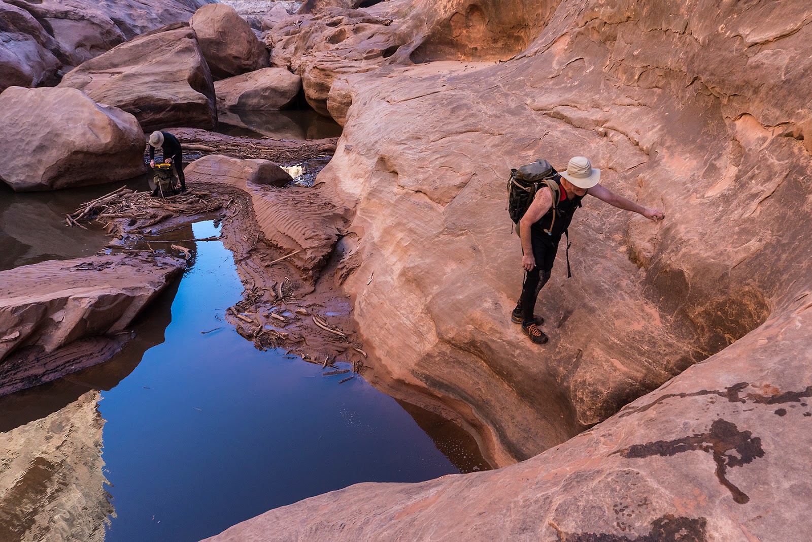
Jim Akers, emerging from one of the early swims.

Asteroid?

Jim and Larry in a Black Hole slot.

Swimming. 

Jim and Larry, emerging from one slot swim...

...and entering another.

More swimming--at one point, we swam past a tarantula sitting on a ledge, but it turned out to be dead. How did it get there in the first place?

Jim Akers in full neoprene.

Warming up, like guards at Buckingham Palace, but less ridiculous.

Easy travel between pools. Note the flood debris wedged in about 30 feet above Larry's head.

Unpleasant travel in log-filled pools. Luckily, there was only one small section like this.

Jim and Larry, avoiding a stinky pool. 

Jim with a stick. You'd have to ask Jim.

A corkscrew section, with occasional water.

Fins and water, deep in the Black Hole.

Larry and Jim approaching a fin section.

Climbing on slickrock to avoid another stinky pool (most were not stinky).

Jim, mucking around before climbing past a stinky section near the end of the difficulties.

Out! We left cars at the beginning and end of the trip, with cold beer in the latter.