Showing posts with label Cedar Mesa. Show all posts

Friday, December 30, 2022

Backpacking: Collins Spring to Slickhorn Canyon #1


Larry and Ellen at the lip of the pour-over in lower Grand Gulch, with the dirt-traverse behind them.
(Click images for larger view)

Every outing, whether rock climbing, packrafting, canyoneering, or even backpacking, has a crux, usually generating at least a little pre-trip anxiety. This makes trips feel more adventurous even though the anxiety is relative and usually unfounded. Climber and Patagonia founder Yvon Chouinard famously said, “for me, when everything goes wrong – that’s when adventure starts.” 


I’m lucky in that I can have adventures just imagining a few things going wrong or sometimes, only one thing. 


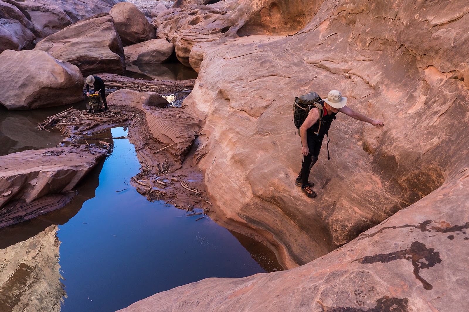
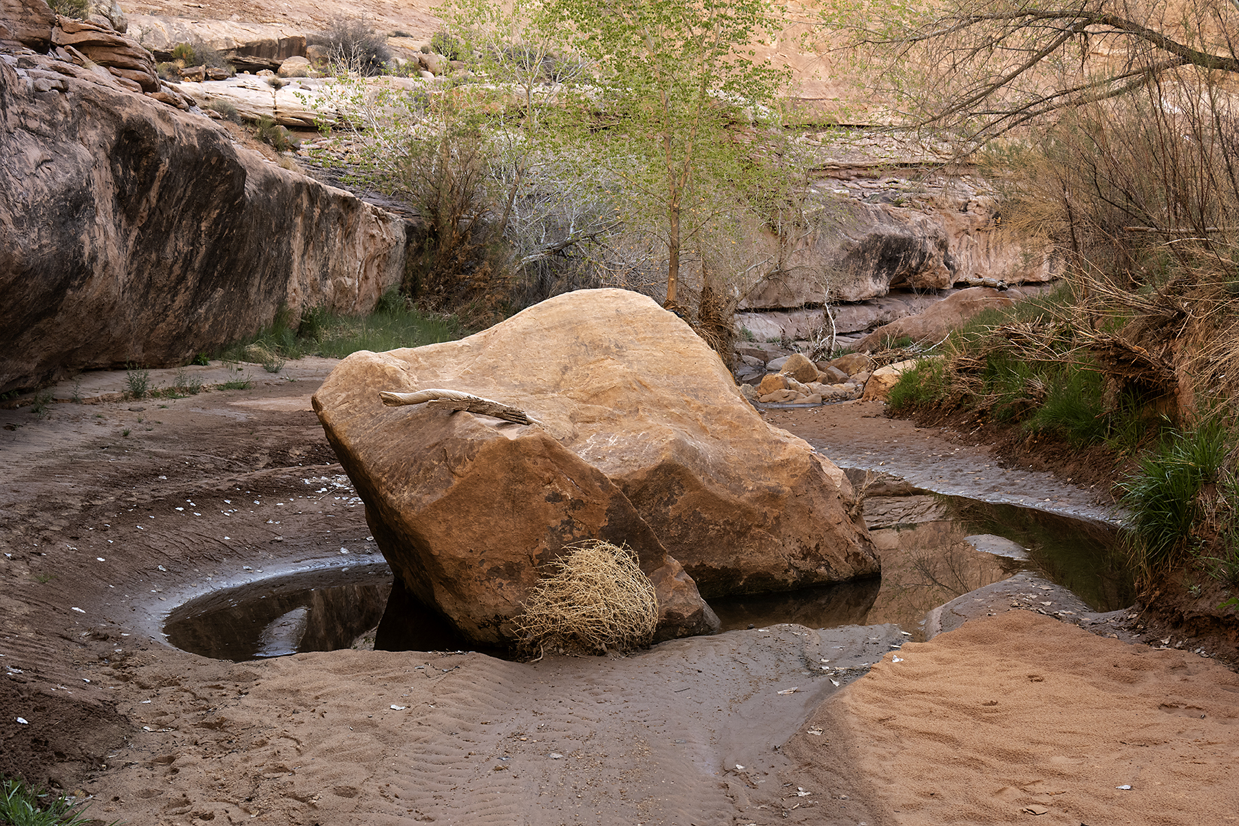
In Utah’s lower Grand Gulch, the pre-trip anxiety-producer is the pour-over low in the canyon just above where it meets the San Juan River. Pour-overs are common on the Colorado Plateau where sedimentary bedding planes meet headward erosion, sometimes undercutting them and leaving a drop into the canyon below. These can often be bypassed on one side or the other by side-hilling and scrambling, but sometimes they are impassable except by technical means (rappelling, downclimbing, handlining, etc.). 


The pour-over in lower Grand Gulch was once easily bypassed, but a rockslide obliterated the trail, leaving a nearly vertical mess of dirt and loose rock that according to descriptions and videos that I nervously watched before we set out, could be traversed sketchily by scrambling across the exposed dirt cliff, a no-fall situation. According to trip accounts, hikers often lowered (or hoisted) their packs over the lip of the pour-over with rope to improve their odds and their balance on the traverse. On the other hand, the route from Collins Spring to the river is a common timed-challenge for long distance runners, who don't ever mention the pour-over in their accounts, presumably racing over it with enough momentum to avoid gravitational danger, like Basilisk lizards (aka Jesus Christ lizards) that can run across the surface of lakes.


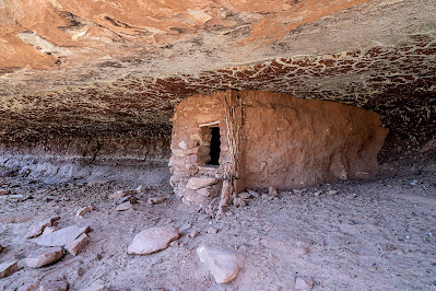
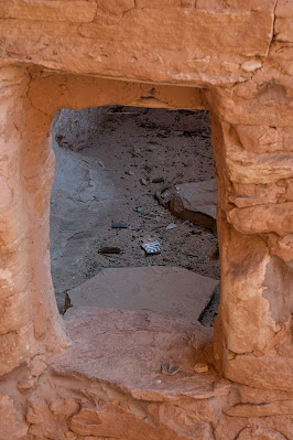
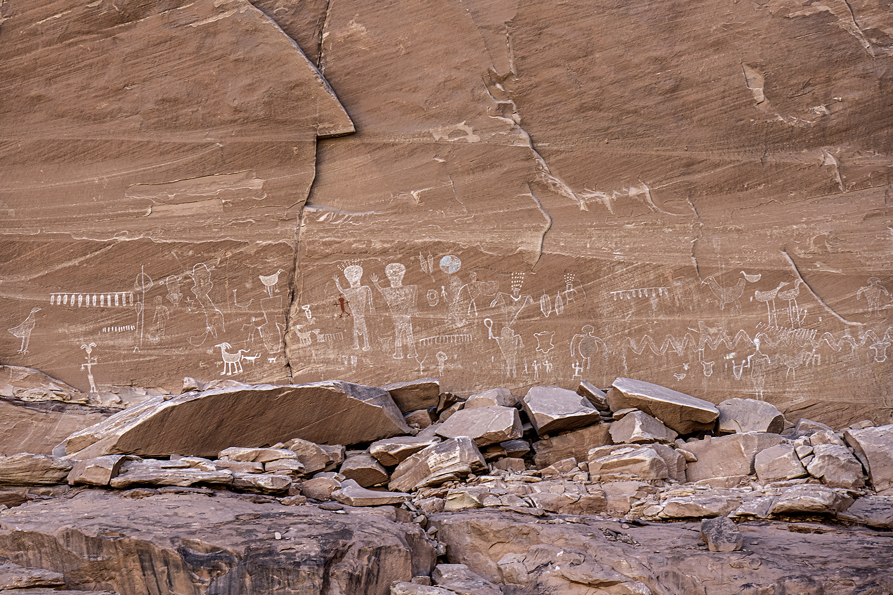
But I’m getting ahead of myself. For years, I kept a mental list of trips to do when freed from spring and fall teaching—prime time in the desert since summers are too hot and winters too cold. One of them was a hike down Grand Gulch to the San Juan, then upriver to the mouth of Slickhorn Canyon, and finally up Slickhorn to its head. Cedar Mesa (aka Bear’s Ears) is famously packed with archaeology and rock art, and it’s beautiful.


I’d originally imagined a longer hike starting at the Kane Gulch Ranger Station but having already hiked upper Grand Gulch (and many of its side canyons; (e.g., blog posts herehere), I instead planned a five-day post-retirement hike with Ellen, Bay Roberts, and Larry Scritchfield in April 2022 starting at Collins and exiting at Slickhorn #1 (one of the upper Slickhorn trailheads). I’d met a canyoneer the previous spring at the Collins trailhead who was starting this route by himself, and he mentioned carrying a rope for the pour-over, so I did my anxiety-producing due diligence and made a plan to carry a harness, rappel device, and 65’ of supertape (lightweight climber’s webbing) just in case. We’d hike down Grand Gulch first (rather than starting at Slickhorn) so that the drop could be descended with the webbing rather than ascended via the death-choss.


It all worked out as it almost always does. The webbing rappel off the pour-over from a large cottonwood tree growing conveniently at the lip was fast and easy, and the rest of the hike was interesting and enjoyable with lots of fascinating rock art, great ancestral Puebloan structures, perfect campsites, and lovely weather. We saw few people, except for a large NOLS group camped just above the pour-over having survived the mandatory (since they were traveling up-canyon) dirt-traverse the previous afternoon. I would not have wanted to be responsible for (or have watched) that mission, but the group seemed unphased as they lounged in folding chairs cooking biscuits in oil, surrounded by a vast scatter of heavy gear that they had carried for a week or more and were destined to carry for weeks to come. 


Towards the end of the hike, we scrambled high up a talus slope into the arc of an abandoned river bend (rincon). Pictographs of birds and other figures adorned the orange sandstone cliff from where we sat all the way around to the other side of the rincon where they were painted in impossibly precarious sites. Below us, the broad canyon offered appealing campsites with pools of water glinting in spring sunshine. Trip anxieties dissolve quickly.


Photos of the hike are below and a little info on logistics with a link to a more detailed trip description is included below the photos. Much of the archaeology is oft-visited and well-known, but I won’t provide specific locations. 


Ellen, Bay, and Larry hiking down lower Grand Gulch below Collins Spring and the Narrows.

The 100-hands panel.

Larry in lower Grand Gulch. I'm never fast enough to take photos of my friends hiking toward me.

Larry approaching a pictograph panel to get a closer look.

Pictographs at the anthropomorph panel.

Ellen and Larry enjoying rock art.

Pictographs.

Bird tracks leading to a bird! 

Ellen and Bay enjoying camp.

Lower Grand Gulch.

Spring cottonwood leaves.

Ellen, Larry, and Bay in lower Grand Gulch.

Hand prints.

Puzzling over petroglyphs on a boulder.

Lower Grand Gulch below one of our campsites.

Larry rappelling off the pour-over on our third  day out with Ellen and Bay waiting above. This was safer and easier than exposed dirt traversing.

L to R: Ellen, Bay, and Larry at the beginning of the straightforward but arduous traverse along the San Juan River from Grand Gulch to Slickhorn Canyon.

Resting in the hot sun mid-traverse.

Enjoying lower Slickhorn on the fourth day.

Ellen and Bay in Slickhorn Canyon.

Granaries.

Bird pictographs.

Ellen on the easy bypass around an even larger pour-over near the head of Slickhorn Canyon on our last day. 

Logistics: Permits are required for backpacking in Grand Gulch and Slickhorn. We left a car at the Slickhorn #1 trailhead and drove a second car to the Collins Spring trailhead to start the hike. There’s dispersed camping along the road into Collins Spring and near the Slickhorn trailhead (and all over Cedar Mesa) or you can stay at the paid campground at Natural Bridges National Monument (first come first served). 


The hike itself took us 5 days and 4 nights, enough time (but more is always better) for exploring ruins and art—we camped twice in lower Grand Gulch and twice in Slickhorn Canyon, finding ample water flowing in the main drainage in Grand Gulch and good water at all of our camps (spring 2022) in Slickhorn as well. 


The main technical obstacle is the pour-over near the bottom of Grand Gulch, not far upcanyon from the San Juan River and described above. We carried a 65’ length of 9/16” climbing webbing (lighter than rope), one harness, and one rappel device and rappelled off a large cottonwood tree on the left side of the pour-off looking down canyon, passing the gear up for each person. That worked great, wasn’t scary, and was probably faster than lowering packs and sketching across the dirt cliff one-by-one. 


The traverse from Grand Gulch to the mouth of Slickhorn is arduous but not technical--stay high on a bench coming out of Grand Gulch. There is a mile or so of boulder field side-hilling where we found an intermittent trail before gaining a nice bench that makes for easier hiking (though with some talus sections) and eventually wraps into Slickhorn. There is no water on the traverse (you are high above the river). Continue along the bench into Slickhorn. We camped in a small side drainage a mile or so up Slickhorn that was beautiful and running with clear water. The hike up Slickhorn from there to the trailhead was straightforward. 


There is a very detailed trip description at this website.

Tuesday, February 1, 2022

Backpacking in Grand Gulch: Collins Spring to Kane Gulch


Scott Lehman at one of my favorite petroglyph panels.
(Click on images to view larger)

When I first visited Cedar Mesa in the 1980s, Grand Gulch was obscure, with word-of-mouth descriptions of arduous bushwacking and secret ruins. Since then, guidebooks have been published, books written, and the Bears Ears National Monument created, diminished, and finally restored, hopefully forever. A growing number of people hike regularly in the Gulch and its tributaries, and it seems that everyone has a secret undisclosed discovery, enticing the rest of us to keep looking. Despite growing popularity, it remains one of my favorite places; no one will ever peer into every hidden alcove or look behind every exfoliated boulder to find the last undiscovered treasure, and even without its cultural heritage, Grand Gulch is stunning. 


In March of 2021, I spent a week with Ellen and our friends, Scott and Bay, hiking from Collins Spring to Kane Gulch, about 38 miles. We’d all walked much of this section and many of its side canyons before but in pieces on many trips over many years, so it was fun to traverse it in one hike. 


While the walking was easy (we planned short days to leave time for ruins and rock art), the drought presented challenges. Water in much of the canyon had disappeared, and hikers, us included, planned our days and camps around what little water could be found, some barely drinkable even with filtering. I recently wrote about climate migrations in the Southwest, partly stimulated by this experience of traversing the canyon in a dry year. Until about 700 years ago, it supported a thriving Ancestral Puebloan community. The gist of that post was that drought destabilized their society, leading to abandonment. 


While on this hike, I realized that drought need not be long-term to drive people out. After a few years without good monsoon rains or winter snow, most of the water was gone. How long could permanent residents of Cedar Mesa live and farm without regular rain? A few years? A decade? How much water could they store from ephemeral summer showers or winter snow? Are there enough obscure springs to sustain a substantial population through several dry years? I don’t know the answers to these questions, but when we were in the canyon in March, there was barely water to support a few dozen backpackers on their vacations, passing through the canyon for only a few days. 


These are a few pictures from our trip. Except for some of the well-known sites, I don't specify locations.


Ellen and Bay (not Bei, our daughter!) enjoying pictographs in a Rincon north of the junction of Grand Gulch and Collins Spring.

The Bannister Ruin. We camped near here on the first night. Bannister spring was dry (we carried water from the trailhead) but I scrambled to a pothole above the canyon floor that was filled with good water.

An arrowhead found in the wash and returned to it after being admired. I recommend Craig Child's book, "Finders, Keepers" for those of you interested in respecting archeological finds.

Handprints.

Routefinding is not too tough when you are following a major canyon, but keeping track of side canyons requires some attention.

A small man (me), and woman (Ellen) sit below the Big Man Panel north of Polly's Canyon. 

More handprints. Bay recreates the moment.

An intact granary tucked beneath a reticulated roof.

The bird panel. I carried my lightweight backpacking camera without a very long lens, and these were high above the canyon floor, but you can zoom in to see better. The pictographs are exquisitely detailed. 

Ellen and Bay scrambling to see a ruin and rock art in a side canyon.

Bay (left) and Ellen enjoying rock art.

The breech birth panel. 

Our camp on a ledge above Coyote Canyon. The spring in the canyon bottom produced good water.

A potsherd inside a ruin.

A wall tucked behind a fallen boulder, with pictographs lined up under the arch behind it.

Bay admiring a petroglyph panel at the mouth of Todie Canyon.

After the hike. Left to right: Bay Roberts, Scott Lehman, Ellen Axtmann, and me.

Water info: Grand Gulch was very dry after a multi-year drought and the failure of the monsoon the previous summer. We found water in a pothole (ephemeral) at our first camp near the Banister ruin on a slickrock shelf that required scrambling to access. There was water in lower Collins Canyon and for short way up Grand Gulch from the confluence, and again in pools in the main Gulch just downcanyon from Polly's. Water was available a short way up Green Canyon and farther along in Green Mask Canyon below the well-known rock art site. The Coyote Canyon spring was running. Farther up, we filtered nasty water from a pool under a pouroff down canyon from the mouth of Todie Canyon. We were told that there was water up Todie in the North Fork, but we used our filtered water instead. From there, we walked out to Kane Gulch. 

Don't rely on the BLM office in Monticello, though they may have some information. If the Kane Gulch Ranger Station is open, it’s a more reliable source of information. Of course, there can be much more or much less (!) water depending on the year. 

Another much more detailed blog post on this hike going in the other direction is at this link and there are many other detailed accounts online if you search for them.


Sunday, October 22, 2017

Canyoneering: Black Hole of White Canyon

Larry Scritchfield deep in the Black Hole of White Canyon.
(Click on images to view larger)

It's easy in a blog post to fall into the trap of making a canyoneering trip sound more dangerous and dramatic than it really was, but the Black Hole of White Canyon is one of the pure fun ones, at least in the conditions we experienced--clear and warm early fall weather, no danger of flood, easy swimming, and reasonable water temperatures. Conditions change, and this trip can be more serious, but except for a couple of short stinky pools and a short, tricky climb up a log to get back to the rim at the end (probably avoidable), our trip in early October was not at all scary. We used a short piece of rope to belay the log (thanks, Larry), but otherwise, needed no gear besides our wetsuits. 

Larry Scritchfield on a warm-up hike in Fry Canyon the day before we did the Black Hole.

Approaching White Canyon--it drains a vast complicated area.

Me and Larry at the warning sign that was placed one season when a huge "unstable debris jam" clogged the Black Hole. The jam has since been washed away. 

In White Canyon above the Black Hole.

Getting ready to suit up for the Black Hole--the water was cold enough for wetsuits, but not very uncomfortable with them on.

Jim Akers, emerging from one of the early swims.

Asteroid?

Jim and Larry in a Black Hole slot.

Swimming. 

Jim and Larry, emerging from one slot swim...

...and entering another.

More swimming--at one point, we swam past a tarantula sitting on a ledge, but it turned out to be dead. How did it get there in the first place?

Jim Akers in full neoprene.

Warming up, like guards at Buckingham Palace, but less ridiculous.

Easy travel between pools. Note the flood debris wedged in about 30 feet above Larry's head.

Unpleasant travel in log-filled pools. Luckily, there was only one small section like this.

Jim and Larry, avoiding a stinky pool. 

Jim with a stick. You'd have to ask Jim.

A corkscrew section, with occasional water.

Fins and water, deep in the Black Hole.

Larry and Jim approaching a fin section.

Climbing on slickrock to avoid another stinky pool (most were not stinky).

Jim, mucking around before climbing past a stinky section near the end of the difficulties.

Out! We left cars at the beginning and end of the trip, with cold beer in the latter.