Showing posts with label canyons. Show all posts

Wednesday, July 5, 2023

Desert Packrafting: Escalante, San Juan, and San Rafael Rivers

Our boats beached to walk to a rock art panel on the San Juan River.
(Click images to view larger)

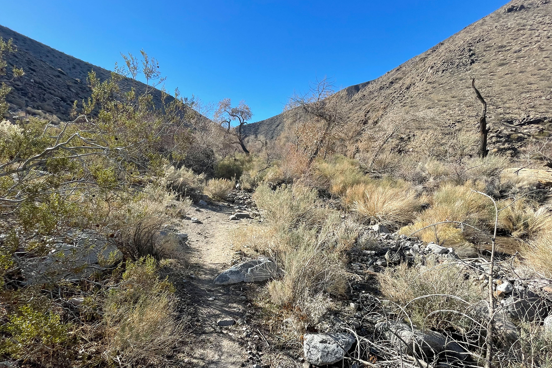
For much of my life, desert rivers have been obstacles or sources of silty water, difficult to cross and hard to filter. The small ones, frigid in the spring, could be waded. Big ones were hiked along, often arduously, or approached, camped beside, and left behind to return the way you came. They are also beautiful green corridors through arid landscapes, lined with cottonwoods and punctuated by rock art galleries and ruins. Sitting on a canyon rim in the hot sun, cliffed-out high above an impossibly green river bottom, you ache to be down in the cool shade.  

Packrafts transform rivers from barriers into people-movers. This spring while drifting along on the San Juan several days into a week-long float, I realized how relaxed I felt, deep in the canyon and far from cell coverage, watching one sandstone formation dip into the river to reveal the younger one above it as we traveled downstream. It was like a days-long sigh of relief.


Kevin Fedarko in his book, The Emerald Mile, about boating in the Grand Canyon, wrote:

To float, to drift, savoring the pulse of the river on its odyssey through the canyon, and above all, to postpone the unwelcome and distinctly unpleasant moment when one is forced to reemerge and reenter the world beyond the rim—that is the paramount goal.

Our Alpacka Explorers, weighing about 7 pounds, plus the paddles, PFDs (life vests), and dry bags, all added to standard backpacking gear, make for heavy packs. We haven’t been ambitious about carrying our rafts very far, instead opting for short approaches. If one is willing to carry the gear, even more terrain opens. Either way, once on the water, you spend your days watching the scenery scroll by. If it’s hot, you swim. If it’s cold, you try not to. Camps are often idyllic with sandy beaches, shade, and side-canyons to explore.

I’ve written before about our first two packraft trips (Oregon’s John Day River and Boquillas Canyon on the Rio Grande) but during the last two spring boating seasons (2022 and 2023), we’ve added the Escalante, San Juan, and San Rafael to our resumes. All of these are exceptional trips in different ways, and there is no shortage of YouTube videos and trip reports, so I won’t add to that pantheon, but I’ll share a few photos and some basic logistics.


Left to Right: Larry Scritchfield, Brian Collins, Ellen, and me, savoring the wind and our heavy packs at the Egypt Trailhead as we set out to Fence Canyon where we put onto the Escalante in April, 2022.

Rigging boats for the Escalante at the Fence Canyon put-in.

Branches and clear water in Neon Canyon during a side hike from the Escalante.

Ellen and Brian on the Escalante, more a creek than a river below Fence Canyon at 6-10 cfs.

Larry during one of many low water boat drags on the Escalante.

Ellen enjoying water stained Escalante cliffs.

Ellen in one of the many small rapids on the Escalante. The river at low water was very busy--nothing especially hard, but requiring constant route finding to avoid hanging up on rocks.

The spectacular Kachina Panel on the San Juan River, less than a day's float from the Sand Island put-in. We ran the San Juan in early April 2023.

Larry Scritchfield and Jane Addis eating lunch at the Kachina Panel.

Spring was late coming to the desert this year, and our first days on the San Juan were cold. This tree knew better than to leaf out.

An arrowhead, left where I found it. The San Juan between Sand Island and Mexican Hat is rich with archaeology. 

Ellen and Bay Roberts at the River House ruin on the San Juan.

An otter accompanied us downriver for a quite a while before climbing onto the shore and running back upstream. We wondered if it was just curious or chaperoning us away from its family.

Ellen in Government Rapid, one of a couple of Class 3 drops on the river. 

The view upstream from our last camp at the mouth of Oljeto Wash. Below Slickhorn Canyon, the river is placid. It was once subsumed by Lake Powell, but has reemerged from the shrinking reservoir.

The San Rafael River in May 2023 at about 150 cfs when we ran it. It later came up to 1,000 before dropping. 

Claret Cup Cactus in the San Rafael Swell.

Ellen and Bay Roberts on the San Rafael.

Ellen and Bay eating lunch in Virgin Springs Canyon on the San Rafael.

Logistics


Escalante


Permits: Required backcountry permit is easily obtained from the Ranger Station in Escalante on your arrival (no lottery, etc.).

Recommended water level: We ran this section when the river was peaking at 6 cfs and it was often lower than that, which was marginal but obviously doable. The recommended water level is at least 50 cfs, but people run it at 2 cfs. The low water made the trip a little more arduous but it was still great.

Shuttle: Our shuttle was from the Egypt Trailhead to the 40-mile Ridge Trailhead. Both are accessed from the Hole in the Rock Road outside of Escalante, which is usually ok for passenger cars (but it can get rough or muddy depending on weather). The spur roads into Egypt and 40-mile Ridge require some clearance and there's sand on the 40-mile Ridge road. We were fine with a Subaru and an AWD van. The shuttle is tedious and takes a couple of hours if I remember correctly.

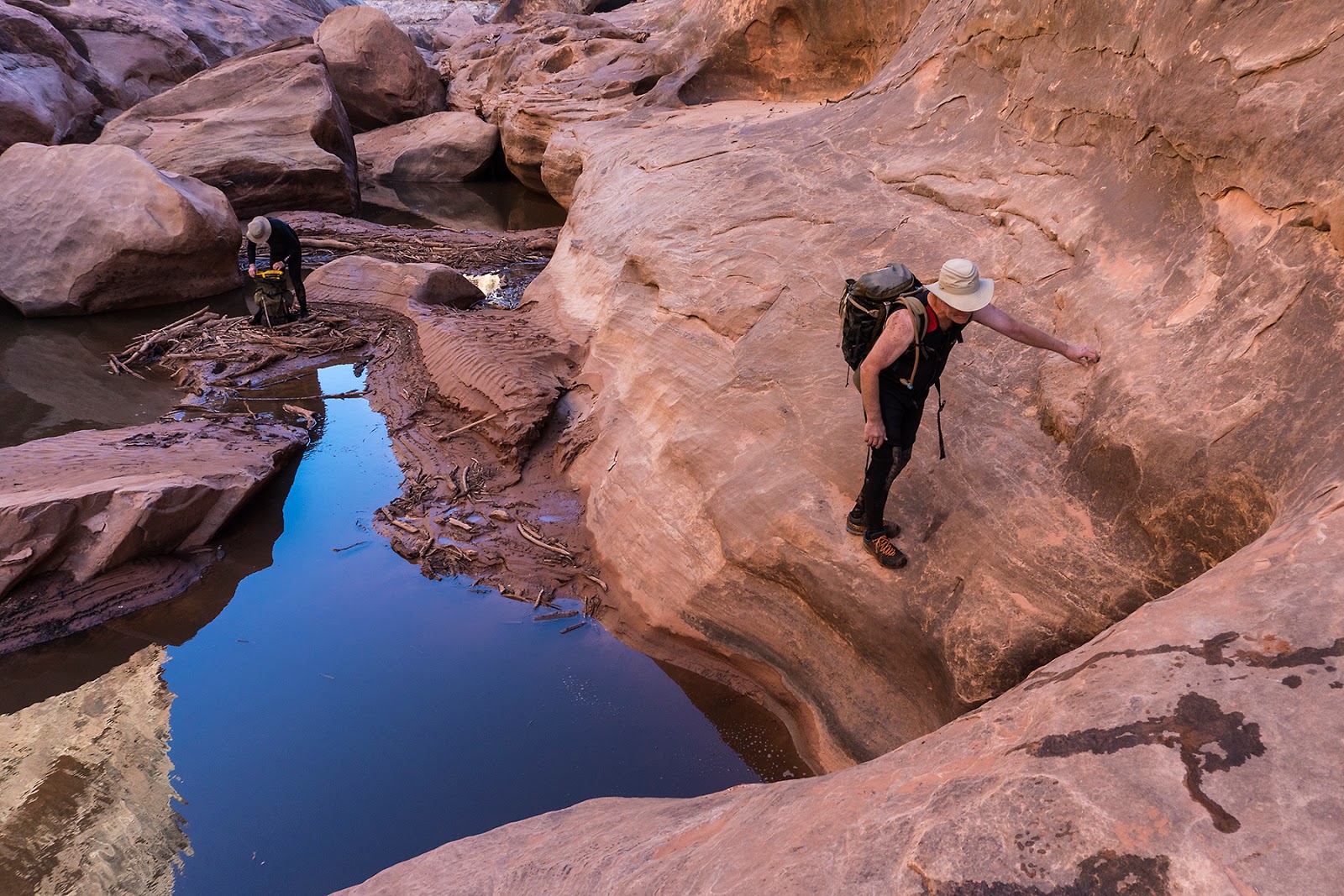
River info: If there’s enough water, you can put in at the Highway 12 bridge near Escalante, but at lower water Fence Canyon is the recommended put in. We started at Fence and took out at Coyote Gulch where we hiked out via the crack in the wall (strenuous hike up a dune but technically easy). Some people float all the way to Lake Powell and get picked up there. The main challenge for us was the low water. We did a lot of butt-scooting and some dragging of boats. Rapids were easy at low water but hard to get through without hanging up. There are two mandatory portages.

Online info: American Packrafting AssociationBearfoot Theory blog, National Park Service.


San Juan


Permits: Required. You can enter the lottery for trip dates between April 15 and July 15 at recreation.gov. For earlier trips, you don’t have to enter the lottery, but you must apply for a permit starting December 1. That’s what we did, and we got a permit, but it was cold for the first few days in April. Later dates are likely to have more water and warmer temperatures.

Recommended water level: >500 cfs. When we were on the river, it was running about 1,000 cfs which was a nice level. 

Shuttle: We paid for the shuttle using Wild Expeditions in Bluff. They drove our van to Clay Hills and left it there for us. Cost was about $250.

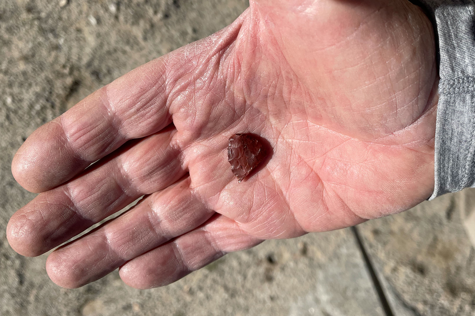
River info: The San Juan is usually boated either from Sand Island to Mexican Hat or from Sand Island all the way to Clay Hills. We took out at Clay Hills. The best archaeology is before Mexican Hat, so plan to spend more time on that section if you can. Also, the left bank of the river is on Navajo lands, and if you want to hike there, you need a special permit (recommended). Chinle Wash is particularly interesting. Call the Navajo Parks and Recreation Department in Window Rock at 928-871-6647.

Online Info: BLMDan Ransom videoGuidebook.


San Rafael


Permits: None required.

Recommended water level: >100 cfs (we ran it at 150 and it was great). They say over 1,000 is not recommended, but I don’t know why not.

Shuttle: Put in is at Fuller Bottom and take out is just upstream from the bridge at the Swinging Bridge Campground. Shuttle by car takes a half-hour or so. Some people do a bicycle shuttle.

River info: Mellow, fun river with no significant rapids (just riffles). Nice side canyon hikes with ruins and rock art. Most do this as a one-day trip, but it can be floated as an overnight. There are lots of nice campsites at side canyons. 

Online info: Bearfoot Theory blog, Road Trip RyanZachary Kenney blog.

Saturday, January 28, 2023

Death Valley Backpacking: Cottonwood - Marble Canyon Loop

View of Death Valley badlands from Zabriskie Point.
(Click images to view larger)

Death Valley is famously hot, dry, and barren, but cold temperatures, flooding, and bushwacking posed challenges during a short visit in January 2023. The park is nothing if not diverse, with elevations ranging from 292 feet below sea level in Badwater Basin to over 11,000’ at the summit of Telescope Peak, so it's not surprising that conditions don't always match the cliches. When I met Larry Scritchfield for a little mid-winter backpacking (and to escape the relentless Wyoming cold), high temperatures averaged around 60 in the basins, way warmer than the surrounding mountains where we hiked, many blanketed with snow. 


Salt Creek on the floor of Death Valley. The white stuff is salt, not snow. (Photo from Dec. 2021 when Ellen and I passed through on our way home from a climbing trip to the Alabama Hills west of Death Valley)

A pan in the Mesquite Dunes east of Stovepipe Wells. (Dec. 2021)

Gower Gulch from Zabriskie Point. Zabriskie Point is a popular roadside overlook, named for a borax magnate. (Dec. 2021)


We’d also hoped to get a taste of Death Valley canyoneering, known for rappels off carefully constructed rock piles (sketchy??), but our canyon partner, Don Reyes, who lives near Lake Tahoe, was digging his renters out of serial Sierra snowstorms and had to bail at the last minute. Canyoneering is collaborative--more fun and safer with three than two, so we postponed those plans.


Larry not canyoneering (still sketchy) in Stretched Pebble Canyon during a day hike. (Jan. 2023)


Larry and I rendezvoused at Stovepipe Wells, just below sea level, where a friendly hotel (showers for $5!) and restaurant on one side of Hwy. 190 face a campground and store on the other. The campground, mostly empty in January, is a gravel parking lot with carbonite posts marking sites, devoid even of picnic tables. We parked on one edge of the lot, giving us access to the empty desert for late-night peeing. Not far to the east, the Mesquite Dunes spawned plumes of dust that thankfully blew away from the campground on frequent windy days. To the west, the Cottonwood Mountains, part of the Panamint Range, where we planned to hike, dominated the skyline, their highest peaks dusted with snow. 


The Stovepipe Wells "campground." It's really just gravel parking places though there are some tent sites that have tables. The Cottonwood Mountains, where we eventually hiked, are in the background. (Jan. 2023)


Flash floods during the August (2022) monsoon washed out many roads in the park, including access to popular tourist spots (Scotty’s Castle, the Racetrack, etc.), and a smaller rain event just before we arrived turned the road to the 28-mile Cottonwood-Marble Canyon loop, our main backpacking objective, into a quagmire. An apologetic ranger at the small Stovepipe Wells station where we stopped to collect our free permit delivered the bad news, squashing our plan to start the 4-day hike that morning. Instead, we regrouped and headed for Indian Pass in the Funeral Mountains on the eastern edge of the park, an overnight out-and-back that included a 4-mile slog up an alluvial fan (fanyoneering?), while we waited for the Cottonwood Canyon road to dry out. 


Camp in the Indian Pass canyon in the Funeral Mts. (Jan. 2023)

Recent rains left plenty of water in potholes in upper Indian Pass Canyon. (Jan. 2023)


Later in the week, after the overnight and two day-hikes, we finally started the loop, which climbs gently up Cottonwood Canyon, then north up a swale to eventually cross a saddle before descending steeply into Deadhorse Canyon which drains into Marble Canyon, itself descending through spectacular narrows back to the trailhead. Along the way we enjoyed impossibly complex geology, petroglyphs (spaceships??), wild horses, freeze-dried lasagna, and perfect but freezing campsites. 


I seldom move much before finishing my morning coffee, and pre-caffeine I don’t even like to be asked about what I might do later in a day. But in one of the hottest places on the planet, it was so cold (and windy) at our first two camps that Larry and I crammed our gear into our packs at dawn and walked until we could find sunshine and a little warmth before brewing freeze-dried Via “coffee” packets and eating breakfast. Probably in the low to mid-20s at night, desert cold always feels colder than mountain cold. I hiked those mornings in the winter clothes (hat, gloves, long underwear, puffy) that I wear Nordic skiing at 9000’ in sub-arctic Laramie, Wyoming and still didn't feel quite warm.


Lower Cottonwood Canyon on our the first day of our loop hike. I ended up shooting iPhone photos on this trip because the sensor on my backpacking camera was unexpectedly dirty. (This and all Cottonwood-Marble photos are from Jan. 2023)

Our first camp in Cottonwood Canyon.

Larry enjoying a wee nip of tequila at our first camp in Cottonwood Canyon.

Larry in upper Marble Canyon.

Approaching one of the narrows in Marble Canyon.

Zebra-striped rock in Marble Canyon.

Petroglyphs in Marble Canyon.

Narrows in Marble Canyon.

Marble Canyon looking towards the narrows in the preceding photo.

Marble Canyon.

Boulder, Marble Canyon.

Another ironic challenge on the hike was vegetation. We joked about bushwacking on the Indian Pass hike whenever we passed close to an infrequent creosote bush. How naïve we were! In Cottonwood Canyon and to a lesser degree in Dead Horse Canyon, what little vegetation there was packed itself into the V-shaped drainages where the few springs provided enough water for trees, choking the canyon with an impassable tangle of downed cottonwood limbs, fallen trunks, and impenetrable shrubs, some thorny, forcing us up onto steep, loose, sidehills above the drainage, sometimes exposed enough to drive us reluctantly back down to bushwack hopelessly until we could find another escape. Short distances near these “oases” took longer to traverse than miles of open desert.

Approaching a section of bushwacking that is WAY worse than it looks. 

The only flake I found on this trip was this broken point that I happened upon while side-hilling above a spring to avoid bushwacking, so perhaps we were not the first to grovel around the springs.


Death Valley is a vast park, too hot most of the year for much activity, but a refuge in winter. From salt flats, dunes, and badlands to mountains harboring ancient but threatened bristlecone pines there’s enormous diversity. And despite the harshness, humans have left their mark with old mines, ghost towns, and remnants of a once thriving borax industry (20-mule trains!). It attracts desert rats and misfits as well as cyclists, outdoor adventurers, and retirees. I find myself there once in a while, and though I often wonder if I’ll return, each trip leaves me curious about just one more thing that I’d like to check out. 


View from an abandoned building at Death Valley Junction, just outside the Park.


Sunday, October 22, 2017

Canyoneering: Black Hole of White Canyon

Larry Scritchfield deep in the Black Hole of White Canyon.
(Click on images to view larger)

It's easy in a blog post to fall into the trap of making a canyoneering trip sound more dangerous and dramatic than it really was, but the Black Hole of White Canyon is one of the pure fun ones, at least in the conditions we experienced--clear and warm early fall weather, no danger of flood, easy swimming, and reasonable water temperatures. Conditions change, and this trip can be more serious, but except for a couple of short stinky pools and a short, tricky climb up a log to get back to the rim at the end (probably avoidable), our trip in early October was not at all scary. We used a short piece of rope to belay the log (thanks, Larry), but otherwise, needed no gear besides our wetsuits. 

Larry Scritchfield on a warm-up hike in Fry Canyon the day before we did the Black Hole.

Approaching White Canyon--it drains a vast complicated area.

Me and Larry at the warning sign that was placed one season when a huge "unstable debris jam" clogged the Black Hole. The jam has since been washed away. 

In White Canyon above the Black Hole.

Getting ready to suit up for the Black Hole--the water was cold enough for wetsuits, but not very uncomfortable with them on.

Jim Akers, emerging from one of the early swims.

Asteroid?

Jim and Larry in a Black Hole slot.

Swimming. 

Jim and Larry, emerging from one slot swim...

...and entering another.

More swimming--at one point, we swam past a tarantula sitting on a ledge, but it turned out to be dead. How did it get there in the first place?

Jim Akers in full neoprene.

Warming up, like guards at Buckingham Palace, but less ridiculous.

Easy travel between pools. Note the flood debris wedged in about 30 feet above Larry's head.

Unpleasant travel in log-filled pools. Luckily, there was only one small section like this.

Jim and Larry, avoiding a stinky pool. 

Jim with a stick. You'd have to ask Jim.

A corkscrew section, with occasional water.

Fins and water, deep in the Black Hole.

Larry and Jim approaching a fin section.

Climbing on slickrock to avoid another stinky pool (most were not stinky).

Jim, mucking around before climbing past a stinky section near the end of the difficulties.

Out! We left cars at the beginning and end of the trip, with cold beer in the latter.