Saturday, January 25, 2014

Ephemeral towns around Wyoming's Great Divide Basin

The view east from Bairoil, Wyoming.  
(Click images to view larger)

Through history people have lived around the margins of endorheic basins.  Some are filled with water, like the Aral Sea in Central Asia, while others are seas of dunes, like the Tarim Basin in Western China, once an obstacle that split the Silk Road into two routes to avoid the Taklimakan Desert (rough English translation:  If you go in, you won't come out), that occupies its interior.  The Taklimakan is so dry that natural mummies, so well preserved despite their 3000+ years that you can look into their faces and imagine them alive, sometimes emerge from the sand.  Some have red hair and blue eyes, immigrants to China from Europe. 

Tuyuguo, a still-occupied town on the margin of the Taklimakan Desert.

Endorheic is a technical term that describes places with no external drainage—rain that falls in these basins doesn’t find its way to the ocean, instead evaporating in place or seeping into groundwater.  Death Valley, famously hot and below sea level is endorheic.   

Wyoming’s Great Divide Basin (GDB), another endorheic basin, is not so well known or so well protected, and many people don’t know that the Continental Divide splits around it after descending from the Wind River Mountains to its north.  In all, it occupies about 3,900 square miles of mostly BLM land, with significant areas owned by ranchers, leased by energy companies, or occupied eccentrically (or creepily if that’s a word) by a handful of desert dwellers. 

Were it not for energy extraction, there would be little reason for most people to live near this harsh place.  It shares Wyoming’s howling wind and frigid winter with the rest of the State, but none of its spectacular mountains, though the Ferris, Green, and Wind River ranges are visible from within.  Around the margins are ephemeral towns that come and go with the fickle energy market:  Wamsutter, Lamont, Bairoil, and Jeffrey City.  A few larger and more permanent towns occupy sites along the Union Pacific Railroad to the basin's south:  Rawlins and Rock Springs are the largest.

I’ve photographed in and around the GDB for years, usually drawn to abandoned houses in the interior or wild horses that live there, or to desert places like the Honeycomb Buttes, but in January Ed Sherline and I left Laramie to have a look at some of these towns, each with its own character, and all temporary.  I doubt that any have the staying power of China’s Silk Road towns, still present all of these thousands of years after they were established. 

Jeffrey City is perhaps the most “famous” of the GDB towns among ghost town aficionados and in the boom-bust history of the West, though it isn’t truly a ghost town;  50-100 people still live here. In summer, cross-country cyclists stop for a meal and a place to sleep after pedaling across this particularly empty stretch of Wyoming.  In winter, snow drifts into abandoned townhouses and dormitories built to house workers during the uranium boom in the late 1970s.  A church, a bar, and a potter's shop are still used, but most other businesses as well as a modern brick building housing and Olympic-sized swimming pool are closed up tight.  

Bachelor Apartment #2.  Jeffrey City, Wyoming.
   
 Named “Home on the Range” by its first homesteaders in the 1930s, the town was renamed in the late 1950s for C.W. Jeffrey, a Rawlins doctor who financed a plan to extract uranium from nearby deposits to fuel nuclear power plants.  Jeffrey City boomed until the nuclear power industry suddenly declined after the Three Mile Island meltdown in 1979.  In fact, the decline was breathtaking.  95% of Jeffrey City’s residents left in a two-year period.  The story is fascinating, and I won’t reproduce it here, but if you’re interested, an Idaho researcher named Michael Amundson published an engaging and comprehensive history that can be accessed online (pdf).

Ed and I skirted the eastern and northern margins of the GDB on a snowy, grey, windy day, stopping in Lamont and Bairoil before finding a campsite at the little-used Jeffrey City landfill in Crook's Gap, chosen not for aesthetics, but because it occupies a drainage perpendicular to the prevailing wind.  We woke before dawn, made coffee, packed our frozen and unwashed dinner dishes, and headed back north to photograph Jeffrey City in the dawn light.  Then, like many before us we drove away.

Grandma's Cafe (then "Anelope" [spelling correct] Cafe), Lamont.  

Trailer, Lamont, Wyoming.

Trailer, Lamont.

Well pipe, Bairoil, Wyoming

International truck.  Bairoil.

Truck interior, Bairoil.

International truck door.  Bairoil.

Baptist Church.  Jeffrey City, Wyoming.

Hair, Etc.  Jeffrey City Quonset hut.

Green Mountain Bus Lines.  Jeffrey City.

Volkswagen with no volks.  Jeffrey City.

Trailer and town homes.  Jeffrey City.

Not town home.  Jeffrey City.

GMC truck interior.  Jeffrey City.

Tuesday, January 7, 2014

Lucca, Italy

The busy streets of Lucca in summer.  Shopping is rampant.
(Click images to view larger)

Last summer (2013), after our battles with the crowds and heat at Cinque Terre, we high-tailed it to Lucca, Italy, which we'd been told was a fun place to stay with easy access to the famous Leaning Tower of Pisa, a sight the girls wanted to see despite the Tuscan heat and previous experiences with tourist hot-spots.  

What a relief Lucca turned out to be.  We stayed in a perfect apartment (Airbnb) and enjoyed a couple of nice days exploring the narrow streets of this cosmopolitan town, just missing the summer festival with concerts by the likes of Leonard Cohen, Neil Young, and Earth, Wind and Fire.  We stumbled onto a surprise exhibition of photographs by Henri Cartier-Bresson, famous for capturing "the decisive moment" with his Leica rangefinder, and we ate lots of gelatto, climbed old towers for the views, hiked around the city walls, and relaxed a bit before our dash to Milan for our flight back to New York. 

A tiny amount of history seems called for.  Lucca was founded by the Etruscans and became a Roman colony in about 180 B.C (see Wikipedia).  Julius Caesar ("Who the hell is Julius Caesar?  You know I don't follow the NBA!" --Will Ferrell from the recent Anchorman sequel) spent time here.  The composer Puccini was born in Lucca and played his organ here during his childhood. Because Lucca survived WWII unbombed, many features of the Medieval town are preserved, most famously the town walls, which are now pedestrian promenades.  And of course, Neil Young played his mouth organ here in 2013, but we missed it, though I'm not bitter about that.

Enough of that...here are a few photos from Lucca, a town I recommend if you need to stage yourself near Pisa and if you enjoy Parmesan, vinegar from Modena, and shade.       

Bei, Lauren, and Leigh passing through the town wall into Lucca.

Typical store in Lucca selling "tipico" stuff.

Statues on one of the cathedrals in town.

Ellen denying herself a gelatto.

Photos by Henri Cartier-Bresson.

Photo of William Faulkner by Cartier-Bresson.  To me, Faulkner looks a lot like my grandfather (see below).

My Dad (left), with my grandfather (Ken), and grandmother (Nelle).  We have other family photos in which my grandfather Ken looks even more like Faulkner, but this is the only one I have on my hard drive.

Lucca mailboxes.

Street scene with bicycle.

Cars aren't allowed on many of the streets, so bikes are preferred, though tricky in the summer crowds. 

Cyclist with wine.

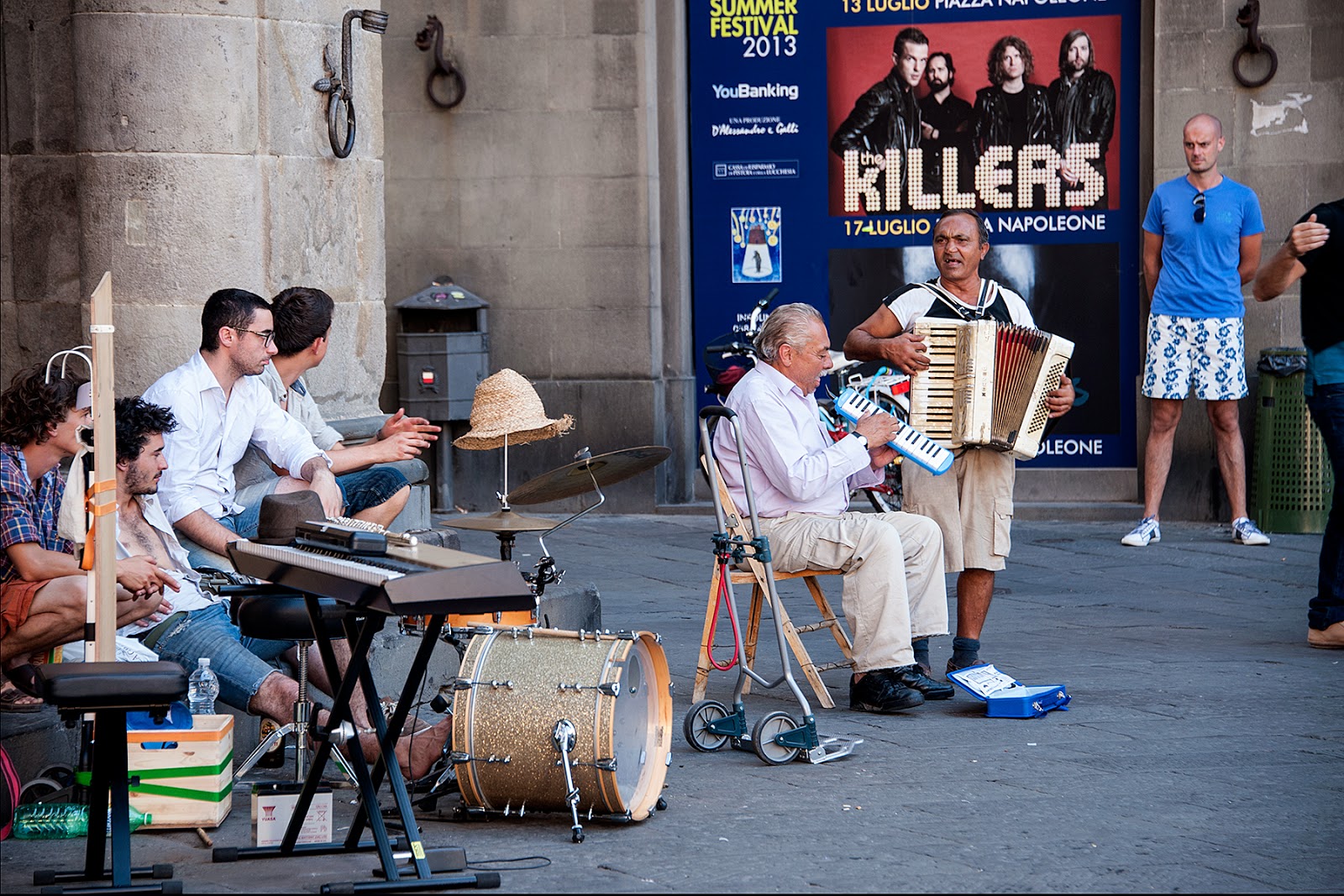
Not Neil Young (or the Killers).


A Lucca summer wedding.  Onlookers point, chant, and dance as the couple emerges.

The girls, dressed to kill and heading out on the town just before ditching their embarrassing grown-up nemeses (me and Ellen).

For you climbers, an anti-stemming device.

A Euro-cat trying to get into one of those Euro-cat calendars, but feeling a little down because he wasn't born in Santorini.

Cathedral sculpture.

Architectural history in brick.

Tuscan weather.

Lucca from one of the many towers in town, none of which are leaning.

A Lucca tower.

The cafe scene at night.

Ellen exploring, just before bedtime.


Friday, December 27, 2013

Cinque Terre: No Parking

Picturesque Manarola, Italy.
(Click images to view larger)

I'm enjoying the holiday and trying to catch up on processing images from the last year, including many from our trip to Europe.  And I'm looking forward to blogging more regularly.  The fall semester overwhelmed me.  I'll start here with a brief description of Cinque Terre on the Italian Riviera.  We visited this at the very end of our summer trip.  I'll post about other European adventures as I get images organized.

The very tiny downside to an academic appointment is that one can travel only in the "high season." In the Northern Hemisphere, this means summer temperatures and summer crowds, and in Europe, where the vacation mentality is saner than in the U.S., it means that every location even hinting at fame becomes overrun with European tourists mixing with those of us from overseas. 

Perhaps I should have known that a place that popped up during a web search for interesting things to see in Northern Italy would not be a great high season choice.  But the pictures of Cinque Terre were so compelling(!):  five lovely little towns pasted to a steep rocky section of the Mediterranean Coast and connected by a hiking trail that could be traversed in a day. What a perfect place to finish a lovely trip!

Cinque Terre has a long history, with towns dating back to at least the 11th century, but for most of this time, the area was isolated by the terrain and a difficult place to live.  While fishing may be a viable way of life, farming doesn't seem to make much sense, and yet the locals over time hacked an elaborate system of terraces into the slopes and planted olive trees and vegetables.  Eventually, a railroad was built along the coast, connecting the five villages to the larger city of La Spezia to the south and providing tourist access, which has transformed Cinque Terre since the 1970s from a backwater to a bustling collection of hotels, restaurants, and shops.  Remarkably though, the original charm of the villages largely remains, at least visually. 

We spent 3 days at Cinque Terre before moving to Lucca, a little farther south, our last stop before flying home from Milan at the end of our month in Europe. Though Cinque Terre is beautiful, I'd avoid it during the high season.  We drove our rental car to a small village high above the coast (Volastra), the only place where I could find a place to stay on late notice.  Avoid that if you go.  Instead, make a reservation in one of the seaside towns (Riomaggiori, Manarola, Vernazza, or Corniglia are best--book early), park in La Spezia, and take the train to your destination.  Check on the status of the hiking trail, damaged by a 2011 landslide and not completely open while we were there, dashing our hopes for a nice hike. And avoid mid-summer crowds and heat if possible.  I was told that the scene in the fall is completely different.  Still, I'm glad to have seen Cinque Terre.  

A few images...

The town of Vernazza.

The harbor at Manarola.  The cool water was a lifesaver if you avoided the jellyfish.

Rock diving at Manarola.

Bei (L) with her cousins Lauren and Leigh, gazing at the Mediterranean.

Manarola.

Boats at Manarola.

Bei was in her element, which is the element where you eat pasta for every meal.  

The coastline is probably too rocky and steep for traditional cemeteries.

Fishing in the Med.

Railway at the edge of the sea.

Castiglioni.

Ellen hiking into Vernazza, after sweating it out on the trail through the olive groves between here and Corniglia.

Decoration in the Volastra cathedral.

A disgruntled cat in Volastra, perhaps unhappy about the tourists?

No parking.  
The five towns were nearly impossible to access with a car, because parking is so limited.  Take the train!